natural wonders

Exploring Majestic Fjaðrárgljúfur Canyon: Your Ultimate Guide

Moss-covered cliffs, glacial rivers and scenic overlooks at Fjadrargljufur Canyon in south Iceland. Get tips on hiking, travel and making the most of this gorgeous natural attraction.

A handsome gay couple stands in front of Fjaðrárgljúfur Canyon, ready for a hike

Imagine walking through a landscape that feels straight out of a fairytale, with moss-covered cliffs, glacial rivers and breathtaking viewpoints at every turn. That’s exactly what you’ll experience at Fjaðrárgljúfur Canyon, one of Iceland’s most incredible natural wonders. Whether you’re an adventure lover, a photographer or just someone who loves stunning landscapes, Fjaðrárgljúfur (also spelled Fjadrargljufurcanyon and pronounced something like Fyath-rou-ar-glyoo-fur) is a must-visit on your Iceland itinerary.

Fjaðrárgljúfur shot to worldwide fame when Justin Bieber filmed parts of his “I’ll Show You” music video here in 2015.

Since then, visitors have flocked to witness its incredible beauty firsthand.

Ready to explore? Let me take you through everything you need to know, from where it is, how to hike it and why this place will leave you speechless.

Overview of Fjaðrárgljúfur Canyon

Fjaðrárgljúfur Canyon is a jaw-dropping gorge located in southern Iceland. Carved by the Fjaðrá (Fyath-rou) River over thousands of years, the canyon is about a mile (2 kilometers) long and can reach depths of up to 330 feet (100 meters). Its steep, moss-covered cliffs and flowing river make it one of the most picturesque spots in the country.

What makes it even more special? The canyon is believed to be around 2 million years old, formed during the Ice Age as glacial waters carved their way through the rock. Today, it’s a popular stop for travelers looking to soak up Iceland’s natural beauty and enjoy a peaceful escape into the wilderness.

Fun Fact: Fjaðrárgljúfur shot to worldwide fame when Justin Bieber filmed parts of his “I’ll Show You” music video here in 2015. Since then, visitors have flocked to witness its incredible beauty firsthand.

Where Is Fjaðrárgljúfur Canyon?

Located in southern Iceland, Fjaðrárgljúfur Canyon is about 155 miles (250 kilometers) from Reykjavik. It’s just a short drive off Iceland’s famous Ring Road (Route 1), making it an easy addition to your Southern Region road trip.

The nearest town to the canyon is Kirkjubæjarklaustur, a small village about 15 minutes away by car. If you’re traveling from Reykjavik, expect the drive to take around 3.5 hours, depending on stops along the way. Trust me, though — the journey is absolutely worth it!

Here are a few ways to get to Fjaðrárgljúfur:

  • By car: Renting a car or camper is the most convenient way to reach the canyon. This gives you the freedom to stop at other incredible sights along the way. If you’re exploring Iceland with wheels, check out these options for campers in Iceland.

  • Guided tours: If you’re short on time or prefer not to drive, many tour companies offer daytrips to south Iceland, including stops at Fjaðrárgljúfur.

Pro Tip: The road to the canyon’s parking area is gravel but well maintained. You don’t need a 4x4 to get there, but drive carefully, especially in winter conditions.

Two women sit and tie the laces on their boots for a hike along Fjaðrárgljúfur Canyon in Iceland

Fjaðrárgljúfur Canyon Hike

If you love a good hike, you’re in for a treat! The Fjaðrárgljúfur Canyon hike offers some of the most incredible views in Iceland and is accessible for almost everyone. Here’s what you can expect:

Hike Overview

  • Distance: About 2 kilometers (1.2 miles) roundtrip

  • Duration: 1 to 1.5 hours

  • Difficulty: Easy (family-friendly)

  • Trail type: Out and back

The trail starts at the Fjaðrárgljúfur parking lot and follows a well-marked path along the canyon’s edge. It’s an easy, gradual hike with multiple viewing platforms where you can stop, take photos and admire the stunning gorge below.

Key Highlights of the Hike

  1. The viewpoints: Along the trail, you’ll come across several scenic overlooks, each offering a unique perspective of the canyon. The Fjarðarárgljúfur viewpoint near the end of the trail is the most spectacular, providing a panoramic view of the canyon and the river winding through it. Trust me — you’ll want to spend some time here just soaking it all in.

  2. Moss-covered cliffs: One of the most magical aspects of Fjaðrárgljúfur is its moss-covered cliffs. The vibrant green moss, combined with the deep canyon walls, creates an almost otherworldly landscape. It’s no wonder photographers love this spot!

  3. The river below: As you hike along the edge, you’ll hear the sound of the Fjaðrá River flowing through the canyon. The water is crystal-clear and adds to the serene, peaceful atmosphere of the area.

Pro Tip: If you want to avoid the crowds, visit early in the morning or later in the evening. The lighting during sunrise or sunset also makes the canyon look even more magical!

Can You Hike Down Into the Canyon?

While the upper trail along the canyon’s edge is open to all visitors, hiking down into the canyon itself is not allowed. This is to protect the delicate moss and the environment, which has been impacted by the growing number of visitors.

But don’t worry — the views from the top are more than enough to take your breath away!

Best Time to Visit Fjaðrárgljúfur Canyon

Fjaðrárgljúfur Canyon is beautiful year-round, but the experience changes with the seasons:

  • Summer (June to August): The canyon is lush and green, with mild temperatures and long daylight hours. It’s the best time for hiking and photography.

  • Autumn (September to October): The fall colors add a stunning golden hue to the moss and cliffs. Plus, it’s less crowded.

  • Winter (November to March): Snow and ice transform the canyon into a winter wonderland. Just be prepared for slippery trails and limited accessibility.

  • Spring (April to May): As the snow melts, the river flows more powerfully, and the moss begins to return to its vibrant green.

Pro Tip: Summer is the busiest season, so if you’re visiting then, try to arrive early to enjoy the canyon in peace.

Tips for Visiting Fjaðrárgljúfur

  • Wear good shoes. Even though the trail is easy, proper hiking shoes will make it more comfortable, especially in winter.

  • Dress in layers. Icelandic weather is unpredictable, so dress in layers and bring a waterproof jacket.

  • Respect the environment. Stay on marked paths to protect the delicate moss and wildlife.

  • Bring a camera. Trust me, you’ll want to capture the incredible views from every angle.

  • Pack snacks and water. There are no facilities at the canyon, so come prepared.

Why Fjaðrárgljúfur Should Be on Your Iceland Itinerary

If you’re exploring the Southern Region of Iceland, Fjaðrárgljúfur Canyon is an absolute must-see. Its combination of natural beauty, easy accessibility and peaceful atmosphere makes it a perfect stop for any traveler. Whether you’re stopping for a quick photo or spending a couple of hours hiking along the edge, this canyon will leave you in awe.

Plus, it’s conveniently located near other south Iceland highlights like Skaftafell, Jökulsárlón Glacier Lagoon and the famous Diamond Beach. Having a camper or car rental will give you the flexibility to explore it all at your own pace.

Ready to experience this magical place for yourself? Pack your hiking shoes, grab your camera and head to Fjaðrárgljúfur. Trust me — you won’t regret it! –Daniel Bailey


Fall Foliage in Japan: A Guide to Experiencing the Spectacular Koyo

Discover the best places for autumn in Japan, including Hokkaido, Nikko, Fuji Five Lakes, Kyoto and Tokyo. Plus, you’ll fall for these  cultural traditions and travel tips.

A handsome man in suit takes pictures of the fall foliage near a bridge and temple in Japan

Japan in fall is a spectacle of vibrant colors and cultural traditions, with every corner of the country bursting into hues of red, orange and yellow. Known as koyo, the brilliant display of autumn leaves makes this the perfect time to soak up Japan’s natural beauty. But if you’re aiming for the best fall foliage spots and wondering about cultural traditions tied to the season, don’t worry — I’ve got you covered.

A hip young woman admires a temple and fall foliage near friendly deer at Nara, Japan
Known as koyo, the brilliant display of autumn leaves makes fall the perfect time to soak up Japan’s natural beauty.

Before heading off, make sure you check the Japan fall foliage forecast for the year so you hit the peak time for those autumn hues. Now, let’s dive into the top spots for fall foliage viewing, starting with the early birds all the way to the late bloomers. 

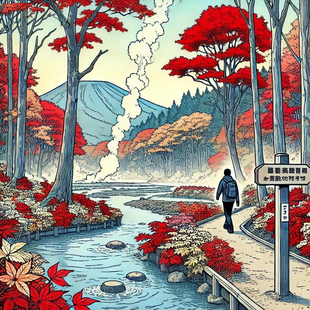
A man hikes near hot springs and red autumn foliage in Hokkaido, Japan

Hokkaido

Japan’s northernmost island, Hokkaido, is home to Daisetsuzan National Park, one of the first places to catch the autumn colors. Starting mid-September, you can hike around Kogen Onsen for a kaleidoscope of leaves. Just don’t forget your bear safety orientation — these woods are home to some of Japan’s most curious critters. Another fall gem? Noboribetsu, known for its eerie “Hell Valley,” where volcanic hot springs and bubbling pools make for a steamy, surreal leaf-viewing experience.

A backpacker stands by a waterfall amid fall foliage with a mountain in the background in Kikko, Japan

Nikko

Nikko offers one of the longest koyo seasons in Japan. The leaf-changing magic starts mid-October near the waterfalls, before spreading in golden waves across Senjogahara Marshland and up to Lake Chuzenji. The stunning contrast of colors against the blue waters is definitely a sight you don’t want to miss.

A backpacker stands by the water, with Mount Fuji in the distance, admiring the fall foliage of Fuji Five Lakes, Japan

Fuji Five Lakes

With Mount Fuji towering above, the Fuji Five Lakes region is undeniably a showstopper. In early November, the northern shores of Lake Kawaguchiko are prime for leaf viewing, with the snow-capped peak looming in the background. If you’re feeling adventurous, this could be your basecamp for a late fall climb.

Shooting stars soar above Kiyomizu-dera Temple in Kyoto, Japan, the area awash in red fall foliage

Kyoto

Kyoto, with its historic temples and gardens, steals the show in mid-to-late November. Arashiyama, known for its bamboo grove, becomes even more magical when framed by autumn colors — yes, the same spot you’ve seen in Memoirs of a Geisha. Kiyomizu-dera Temple, perched above a sea of crimson leaves, offers stunning views, and its nighttime illuminations give the foliage an otherworldly glow.

Shinjuku Gyoen National Garden, with temples and fall foliage amid the skyscrapers of Tokyo, Japan

Tokyo

Even Tokyo gets in on the action. By late November, Shinjuku Gyoen National Garden lights up with reds and yellows, offering a stunning mix of Japanese, English, and French-style gardens. Meanwhile, Koishikawa Korakuen Gardens showcase fiery maple leaves reflected in its serene ponds, blending nature with traditional Japanese design for a peaceful retreat in the city.

A couple with a white dog look up at the maple and gingko trees during fall in Japan

Types of Trees You’ll See for Japanese Fall Foliage

Japanese maple (momiji): The star of the season, momiji trees light up the landscape with their fiery red leaves, becoming the very symbol of autumn in Japan.

Ginkgo: With their distinctive fan-shaped leaves turning a brilliant yellow, ginkgo trees are a common sight in cities, parks and temples and lining streets.

Rowan and larch: Adding splashes of orange and yellow, these trees round out the autumn palette, with larch standing out as the only conifer that drops its needle-shaped leaves for the season.

A train cruises through the mountains and countryside of Japan, with the trees showing fall colors

How to Get Around for Japan’s Fall Foliage

Japan Rail Pass: The perfect ticket to hop between major cities and regions. If you’re planning to cover a lot of ground with long-distance trips, this is both a convenient and cost-effective option.

Public transportation: In bustling cities like Tokyo and Kyoto, the train and bus networks make getting around a breeze. 

Car rental: When you’re heading to more remote spots like Nikko or Hokkaido, a rental car gives you the freedom to escape the crowds and explore at your own pace.

Nihonmatsu Lantern Festival in Fukushima, Japan

Cultural Traditions for Koyo

The Japanese don’t just admire the leaves — they “hunt” them. Momiji-gari, which literally translates to “autumn leaf hunting,” is all about appreciating the vivid colors, particularly those of the maple tree. And don’t be surprised if you spot some maple leaf tempura on menus — it’s a sweet seasonal treat.

The fall harvest also means festivals. Kyoto’s Jidai Matsuri on October 22 brings history to life with participants donning costumes from different periods of Japan’s past. Meanwhile, the Nihonmatsu Lantern Festival in Fukushima lights up the streets with floats covered in glowing red lanterns — it’s a sight not to be missed.

A couple eats sushi with chopsticks on a picnic near a stream amid the fall foliage of Japan, with a fox nearby

Travel Tips for Fall Foliage in Japan

Plan ahead. 
With autumn being a prime time for visitors, accommodations fill up fast. Be sure to book early and keep an eye on foliage forecasts to catch the peak colors.

Layer your clothing. 
The temperatures swing throughout the day, so dressing in layers will keep you comfortable no matter the weather.

Respect local customs. 
Temples and shrines hold a special place in Japanese culture. When visiting, be sure to follow local traditions and show proper etiquette. This might mean taking off your shoes before entering temple buildings, avoiding loud conversations, refraining from taking photos in restricted areas, and bowing to show respect when entering and leaving holy places.

A gay couple walk down a lane under trees in the fall in Japan

On the Hunt for Fall Foliage 

Japan’s autumn certainly wows with its colors — but it’s also the culture, festivals and history that make this season so special. So grab your camera, plan your trip and get ready to “hunt” some of the most stunning fall views the world has to offer. –Julia Hill 


NATURE’S MARVELS

Alaska’s Natural Wonders: An Adventurous Traveler’s Guide to the Last Frontier

The best of Alaska: the glaciers, boreal forests, grizzlies, moose, eagles, orcas and rugged coastlines of the Alaska wilderness.

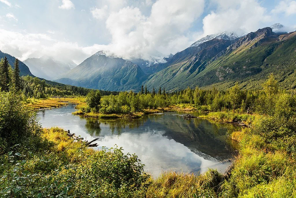
Alaska pond and stream surrounded by greenery with mountains in the background

True explorers can discover the untamed beauty of Alaska: glaciers, forests, wildlife and rugged coastlines.

It’s been referred to as the “Last Frontier” — and for good reason. Alaska is one of the few great wildernesses remaining in the United States. This breathtaking, diverse expanse is an extraordinary spectacle: a diverse landscape of towering glaciers, rugged mountain peaks, vast empty tundras and dramatic coastal plains. It’s one of the most exciting places in the world to explore for adventurous travelers and is packed full of natural wonders waiting to be discovered. 

Massive white cruise ship in the ice-filled waters of Alaska with snow-covered mountains in the background

Aboard an Alaskan cruise, every view is a postcard moment.

An Alaskan cruise opens up a world of awe-inspiring beauty and lets you get to the heart of this remote yet stunning corner of the world. Discover the best landscapes of Alaska’s varied and surprisingly diverse wilderness.

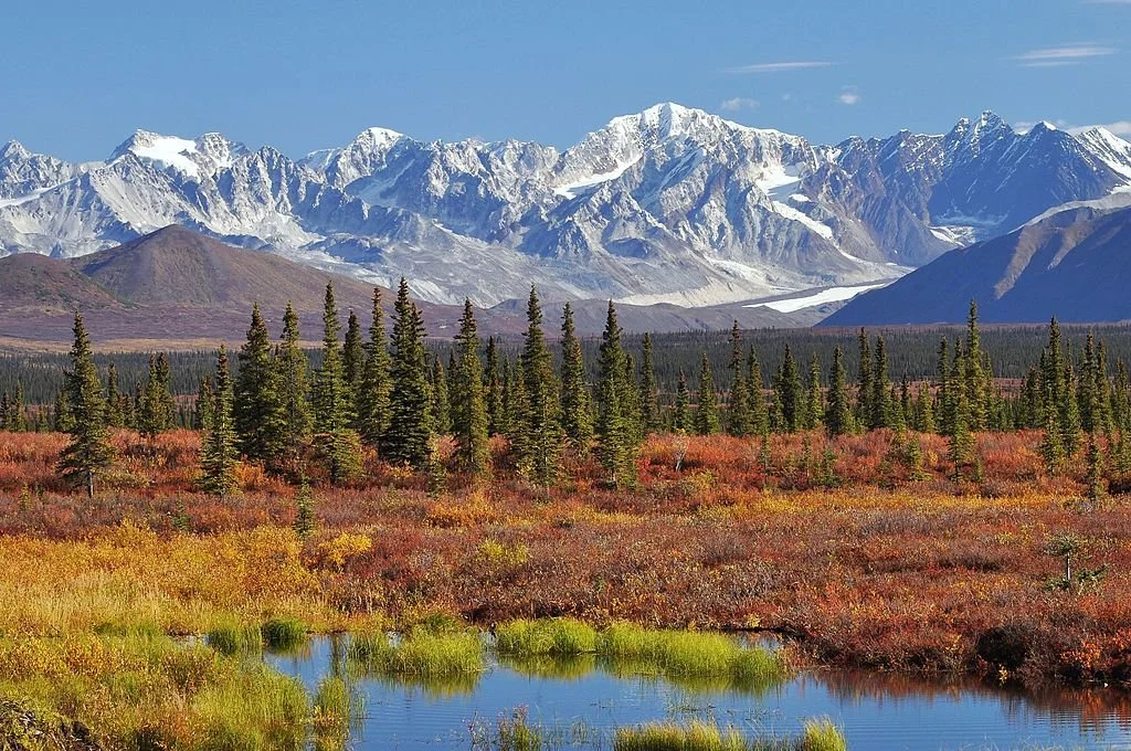
Autumnal tundra with narrow evergreens and snowy mountains of Alaska

Denali, aka Mount McKinley, is the tallest mountain in North America, standing at an impressive height of 20,310 feet (6,190 meters).

Glacier-Carved Mountains

Towering mountain ranges are a constant feature of the Alaskan landscape. Dramatic peaks and rugged ridges dominate the vistas, crowned by snow, ice and glaciers. Some of the continent’s highest summits can be found in the 49th state, including Mount Denali, the tallest mountain in North America. These peaks and valleys, carved over thousands of years by migrating glaciers, are a remarkable place for outdoor enthusiasts to explore, and a great place for hiking, mountaineering and wildlife watching.

Part of a glacier in Alaska slides into the water

Some of the numerous glaciers in Alaska are 30,000 years old!

Majestic Glaciers

Alaska’s glaciers are some of the state’s most popular attractions. The vast ice fields that cover over 100,000 square miles are actually ancient rivers of ice, constantly shifting and imperceptibly flowing, and are responsible for sculpting most of what constitutes the landscape of Alaska. 

While exploring Alaska’s glaciers isn’t for the faint-hearted, a hike over one of these frozen monuments is a unique and breathtaking experience, and you will stand gaping in awe at the towering ice walls, deep crevasses and shimmering blue ice caves. It truly is transcendental. For the less adventurous, a helicopter ride over the ice is also a treat.

Foggy Alaskan forest at sunset with mountains lining the rose-colored horizon

The boreal forest in Alaska takes up about 65% of the state’s land mass.

Wildlife-Rich Forests

Many people think of Alaska as a barren wasteland, but its boreal forests are actually teeming with life and offer an important habitat for a huge variety of flora and fauna. Enormous stands of spruce, fir and cedar spread far and wide across the state and are home to a remarkable variety of ecosystems and natural beauty.

Two moose (one standing, one laying down) in the grass in Alaska

Up to 8,000 moose are hunted every year in Alaska.

Kodiak bear touches its nose to the nose of its cub in Alaska amid plants

Kodiak are members of the grizzly family and are only found on an archipelago in Alaska.

Filled with meandering rivers, tranquil lakes and pristine wetlands, Alaska’s forests are a wonderful way to see the richness and diversity of the state up close. They also offer the chance to encounter some of the Last Frontier’s most iconic wildlife, including grizzlies, moose, wolves and eagles, as well as some more hidden gems such as caribou, lynx and wolverines. 

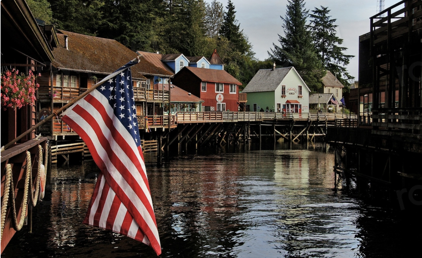
An American flag flies by colorful building on wooden supports over a creek in Ketchikan, Alaska

Ketchikan, known as Alaska’s “first city,” sure looks quaint — but this strip is its historic red light district.

Coastal Marvels

It’s hard to do justice to the rough, rugged magnificence of Alaska’s coastline. Stretching for over 6,600 miles, it stands in stark contrast to the wilderness of the interior, serving up a landscape of rocky cliffs, hidden coves and eye-catching beaches, as well as charming fishing villages and delightful old towns.

An orca jumps in the water by another with just its fin visible in the waters of Alaska

Orcas, aka killer whales, are actually dolphins. But the other part of their name is apt: They’re apex predators that hunt and consume sharks, baby whales and seals.

The coastline also gives visitors the chance to discover Alaska’s marine marvels, with whale watching a particular highlight. The abundant wildlife just offshore includes orcas, sea otters, dolphins and harbor seals. 

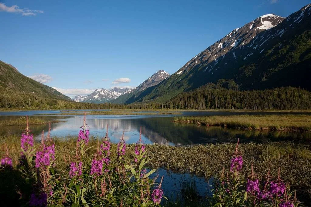
Purple flowers by a pond and snow-flecked mountains in Alaska

Alaska: where adventure meets awe-inspiring beauty.

The beauty and diversity of Alaska’s landscapes cannot be overstated, and a trip to this wonderful state provides adventure, excitement and natural wonders in equal measure. This stunning destination offers a chance to reconnect with nature and should be on every traveler’s bucket list! –Boris Dzhingarov

6 of the Most Unforgettable Galápagos Attractions

What are the coolest things to see in the Galápagos Islands? The giant tortoises of Rancho El Chato, the Bellavista Lava Tunnels, Los Gemelos and the sea lions of Lobería Bay make this a paradise for nature lovers.

A tortoise stands on the rocky shore in the Galapagos Islands

Calling all thrill-seekers! Are you ready to experience the Galápagos Islands like never before? This untouched paradise, situated off the shores of Ecuador, is home to an abundant and awe-inspiring array of wildlife. From giant tortoises to iguanas to penguins, this enchanting destination is a must-visit for nature lovers and adventure seekers alike. 

About 600 miles off the coast of Ecuador in the Pacific Ocean, the remote archipelago of 18 islands and more than 100 small islets was declared a UNESCO World Heritage Site in 1978.

Here are the top six awe-inspiring experiences you won’t want to miss out on during a private Galápagos tour:  

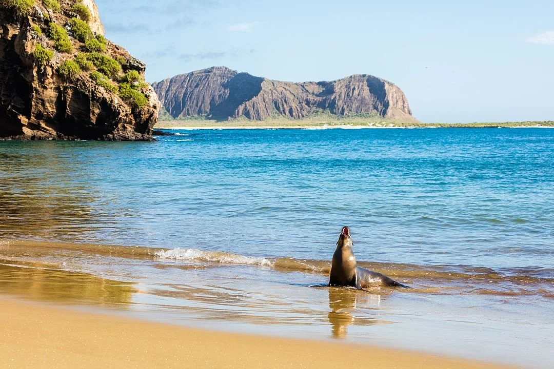
Two sea lions lie in the sand facing each other in the Galapagos Islands

1. Lobería Bay: A Sea Lion’s Paradise

Near Puerto Baquerizo Moreno on the southwestern coast of San Cristóbal Island, Lobería Bay is home to one of the largest sea lion colonies in the Galápagos Islands, and its name, which loosely translates to “Place of the Sea Wolves,” is a fitting one. 

These playful creatures can be seen sunbathing on the rocks, swimming in the ocean and even surfing the waves. Visitors can get up close and personal with the sea lions, but it’s important to remember that they’re wild animals and should be respected.

Adorable tan sea lion stands on the beach in the Galapagos Islands

In addition to sea lions, Lobería Bay is home to a variety of other wildlife, including iguanas, penguins and pelicans. The crystal-clear turquoise waters off the coast are also great for snorkeling and scuba diving: You can see a variety of marine life, such as sharks, rays and colorful fish.

Lobería Bay is a truly special place to witness the spectacle of its namesake inhabitants. Their spirited playfulness and captivating postures make for an unforgettable show.

A bunch of pelicans hope for scraps while fishermen cut up their catches at the Santa Cruz Fish Market in Puerto Ayora

2. Santa Cruz Fish Market: Get Fresh

Located on San Cristóbal’s southern shore in the town of Puerto Ayora, the Santa Cruz Fish Market is a wonderful place to immerse yourself in island culture. Locals come here to select their evening feast among the freshest catches of the day. The market is a hive of activity, with fishermen unloading their boats, vendors hawking their wares and tourists snapping photos. 

You won’t be alone. Pelicans waddle past the counters, and the sea lions poke their heads up beside the sellers stalls to sniff the delicious seafood.

But the real spectacle is the intricate process of weighing and preparing the fish. Yellowtail tunas are hoisted onto scales, groupers are gutted and fileted, and scorpion fish are skinned and cleaned. It’s a fascinating glimpse into the world of commercial fishing, and it’s sure to whet your appetite.

At night, the fish market transforms into an open-air restaurant. The set menu offers a plate of fresh seafood and two sides for a very reasonable price (around $5). 

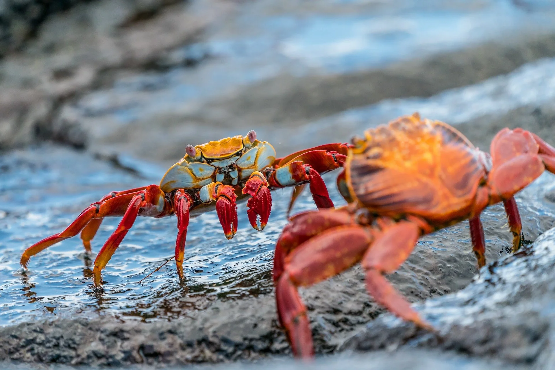
Two bright red Sally Lightfoot crabs face off on the rocks on the beach in the Galapagos Islands

While you’re in the vicinity, head to the black volcanic rock shores to see colonies of brightly colored Sally Lightfoot crabs scuttling about.

A pelican flies over the water by green foliage in the Wetlands on Isabela Island, Galapagos

3. The Wetlands on Isabela Island: A Birdwatcher’s Paradise

The Isabela Wetlands Complex (Isabela Humedales) is a hidden gem located a short distance from Puerto Villamil on seahorse-shaped Isabela Island. This remarkable ecosystem is home to a diverse array of wildlife, including flamingos, stilts (named for their long legs) and pintail ducks. 

The best way to explore the wetlands is on foot, following the network of boardwalk trails that pass through lakes, lagoons and mangrove swamps. The trails are easy to navigate, making them a great option for even inexperienced hikers.

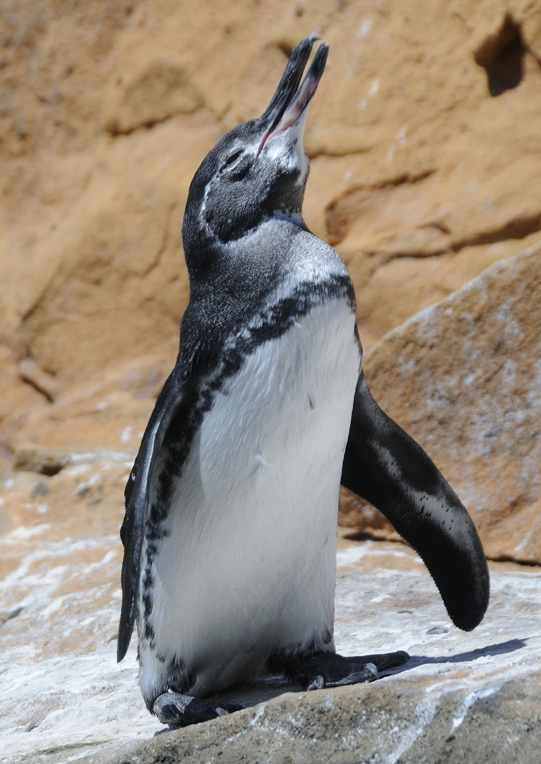
A small penguin lifts its head into the air on rocks in the Galapagos Islands

As you explore the complex, you’ll be amazed by the beauty of the wetland ecosystem. Mangrove trees provide a shady respite from the sun, popular with various plants, insects, amphibians, fish and more. But the real stars of the show are the birds. You can see over 100 species, including some that are found nowhere else in the world. You're likely to see flamingos, flightless cormorants, penguins and gallinules.

A pink flamingo wades in the water, its beak dipping into the ocean in the Galapagos Islands

While here, look for the island’s unusual resident, the Conolophus marthae, or pink land iguana. The slopes of Wolf Volcano are the only place on the planet where they live.

Pink land iguana opens its mouth in the brush in the Galapagos Islands

If you’re not a fan of hiking, you can explore the area on a bicycle. However, it’s best to avoid the afternoon, when the sun is at its hottest.

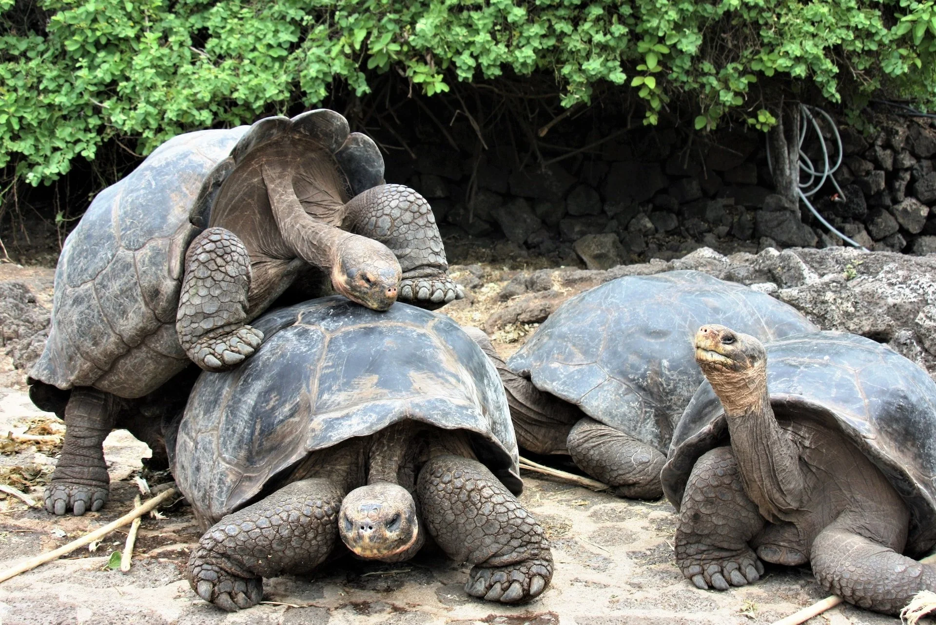
A group of tortoises, including one that is climbing onto another's shell at El Chato Ranch in the Galapagos Islands

4. El Chato Tortoise Reserve: Walking Among Giants 

The Galápagos tortoise is the official mascot of the islands — and for good reason. These majestic, slow-moving creatures are gentle giants, with some specimens weighing up to 550 pounds (250 kilograms). They’re also some of the longest-living invertebrates; the oldest ever recorded was 175 years old!

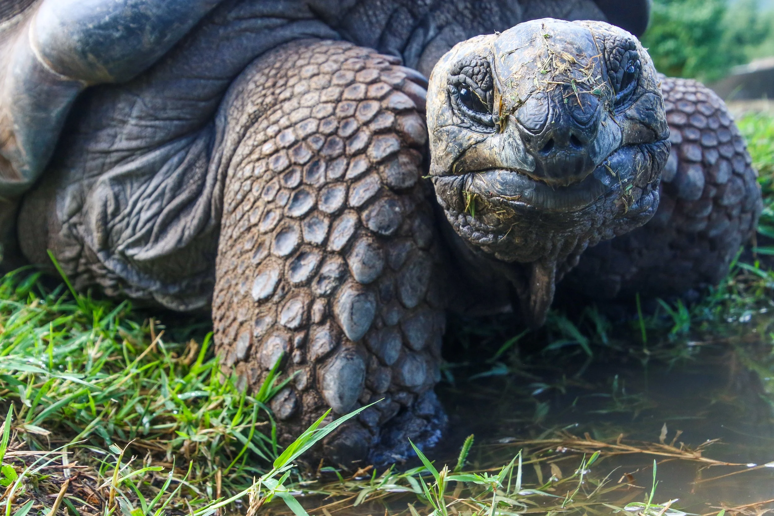
Closeup of tortoise looking straight ahead in grass in the Galapagos Islands

One of the best places to observe them in their natural habitat on Santa Cruz Island at Rancho El Chato. The reserve is located a little over a mile south of the small town of Santa Rosa and covers 29 rolling acres of lush tropical highlands. The ranch’s mission is to provide a sanctuary for this endangered species. The privately owned reserve is home to many free-roaming giant tortoises, as well as Darwin finches and short-eared owls. 

Visitors can hike through the highlands, coming face-to-face with tortoises, as these amazing creatures roam around freely, and learning more about their resilience and longevity. 

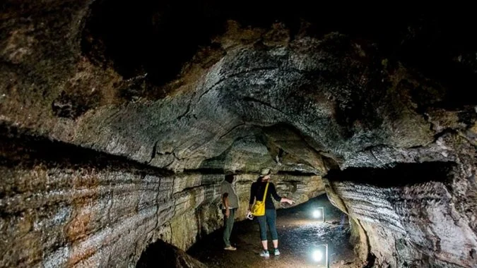
Explorers stand in the striated Bellavista Lava Tunnels in the Galapagos Islands

5. Los Túneles de Bellavista: A Subterranean Wonder

If Puerto Ayora’s your home base, you can find a treasure trove of wonders just beyond its lively fish market, including the subterranean geologic wonders known as Los Túneles de Bellavista, or the Bellavista Lava Tunnels. These underground passages on Santa Cruz Island reveal the sheer magnitude and force of volcanic activity that shaped the Galápagos archipelago.

One of the most popular tunnels can be found near the village of Bellavista. Santa Cruz is the most well-known island for lava flows, which are particularly abundant in the highlands. Visitors can descend underground and marvel at the incredible shapes and formations that were created millions of years ago. 

The tubes were formed as lava flowed over the island’s surface. As the outer layer of lava cooled and hardened, molten magma continued flowing beneath. When the lava drained away, it left behind a series of long cave-like channels.

To get to the Lava Tunnels, you can hire a taxi in Puerto Ayora. The tunnels aren’t well-lit, so be sure to bring a flashlight and wear sturdy shoes, not flip-flops.

Los Gemelos, two round craters surrounded by forest in the Galapagos Islands

6. Los Gemelos and Scalesia Forest: Twice as Nice

If you’re looking for an adventure that will take your breath away, be sure to add Los Gemelos (The Twins) to your list of must-see places in the Galapagos. These two round craters are located on opposite sides of the main Santa Cruz highway and were formed when lava tunnels collapsed due to erosion and tectonic shifts. Today, they stand as untamed and lush havens, inviting adventurous souls to explore their hidden wonders.

The larger of the two craters is about 410 feet deep (125 meters), and the smaller one is about 82 feet deep (25 meters). Both are surrounded by Scalesia forests. These trees are actually part of the family of plants that includes daisies and sunflowers. Scalesia trees are endangered, and they’re only found in the Galápagos. The forests also have a variety of birds, including the vermilion flycatcher and the Galápagos hawk.

Dirt path leading through lush Scalesia forest by Los Gemelos in the Galapagos Islands

A short hike from the main road leads to the rim of the larger crater. From there, you have a breathtaking view of the crater and the surrounding forest. You can also hike down into the crater, but be sure to wear sturdy shoes and be careful of loose rocks.

Sea lion rears its head on the beach in the Galapagos Islands

The Galápagos: Explore a Natural World of Wonders

The Galápagos Islands are a place of wonder and discovery. With playful sea lions, vibrant fish markets, lava tunnels and mighty tortoises, every corner of this archipelago holds something different to explore. Craft your own itinerary with a private tour of the Galápagos Islands — you’re sure to be captivated by its sheer beauty. –Emilia Stefan

What to Know Before Embarking on an Antarctic Peninsula Cruise

Penguins and glaciers and icebergs, oh my! Pro tips and incredible sights to see in the Antarctic, including Drake Passage, Graham Land, Port Lockroy, Palmer Station, Deception Island, Half Moon Island and Paradise Bay. 

Penguin looks out at icebergs and large cruise ship in the Antarctic

A cruise through the Antarctic isn’t for the faint of heart — but could be the trip of a lifetime.

If you’re an adventure seeker, the Antarctic Peninsula is the ultimate extreme destination. The Antarctic Peninsula, also known as Graham Land or Palmer Peninsula, is the northernmost part of Antarctica and part of the larger West Antarctic Peninsula. It lies about 600 miles south of South America.

The landscape is mountainous, and there are numerous volcanoes in the region. You can expect to see a wide range of wildlife, including emperor penguins, killer whales and seals.

Altitude sickness might not be something you think of when visiting the Antarctic, but the highest point is 2.5 miles above sea level.

Taking an Antarctic Peninsula cruise is the best way to explore this remote, inhospitable region.

Large cruise ship offshore of Antarctic Peninsula, where a person in yellow coat and backpack walks

This isn’t your typical cruise, that’s for sure!

Essential Tips for an Antarctic Peninsula Cruise

Find the right time to go

The best time to take a cruise to the Antarctic Peninsula is during the austral summer, which runs from November to March. During this period, the weather is more stable and the days are longer. 

Sunsets can last up to three hours — making for some spectacular photographs. 

Plus, you’re more likely to see wildlife, as animals are more active during the summer. The first penguin chicks hatch in mid-December, so if you want to catch a glimpse of them, this is the ideal time to go. The whales also begin to arrive in mid-December, and there are plenty of them in January. The ice thins a bit, too, allowing tourists to explore farther south.

Antarctic cruise ship in ice-filled water

A luxury cruise ship plies the ice-filled water of the Antarctic.

Choose the right cruise. 

Luxury cruise ships are popular as they offer a variety of itineraries and amenities such as all-suite accommodations, fine dining and experienced guides. However, don’t just settle for any cruise. Conduct ample research to decide if a large or small boat is more suitable for your needs.

A top factor to consider when choosing an Antarctic Peninsula cruise is your budget. You should decide first how much you’re willing to spend. You don’t want to go too high and break the bank, but you also don’t want to go too low and risk a subpar experience. With these criteria in mind, you can narrow down your options and find a cruise that best fits your budget and interests. 

Pack properly. 

The Antarctic Peninsula is cold and windy, so it’s essential to pack the right clothes for the trip. Bring lots of layers and wear waterproof winter gear. 

Don’t forget sun protection, as the sun can be very strong even during the cold season.

Bring several pairs of gloves, a hat, a scarf and sunglasses to protect yourself from the elements. Ensure your clothing is comfortable and non-bulky so you can easily move around during shore visits.

Finally, if you’re an amateur photographer, bring enough memory cards and batteries for your camera. 

Pro tip: Pack a power strip, as the cabins on cruise ships usually have limited electrical outlets.

Waves crashing over the bow of a large ship while crossing the Drake Passage

The roughest stretch of water is the Drake Passage — one of the most turbulent areas in the world.

Prepare for rough seas. 

Be ready to face the unique challenges of sea travel, including:

The Drake crossing: To reach the peninsula, your cruise ship will cross the Drake Passage, where the Atlantic and Pacific Oceans meet. This is one of the roughest stretches of sea in the world. So you never know if you’re going to experience the turbulent “Drake shake” or the tranquil “Drake lake.” I recommend contacting your doctor for any advice before you go and packing enough anti-seasickness medication for this stretch.

Altitude sickness: It might not be something you think of, but the highest point in Antarctica is 2.5 miles (over 4,000 meters) above sea level. On top of that, the average temperature in summer is around -13°F. Drier air, less oxygen, intense cold and harsh winds can trigger altitude sickness. The best thing to do is to drink lots of water to keep yourself hydrated. 

Know the Antarctic regulations. 

To minimize environmental impact on the peninsula, the cruise industry participates in detailed environmental assessments. They also must obey international maritime laws and coordinate itineraries through pre-season planning.

While in the Antarctic Peninsula, you have to follow International Association of Antarctica Tour Operators (IAATO) guidelines:

  • Protect the wildlife.

  • Respect restrictions in protected areas.

  • Keep the peninsula pristine. 

  • Respect scientific research stations. 

Gorgeous blue skies, waters and icebergs in Antarctica

Thanks to the plays of light in the Antarctic, you can end up with some gorgeous photos.

Photographing the Antarctic Peninsula

There’s no shortage of picturesque views in the Antarctic Peninsula. Here are my tips to capture spectacular photos:
  • During the polar summer, from November to February, the sun stays above the horizon and never sets — a phenomenon known as the midnight sun. Take advantage of the unusual plays of light to take pictures of the same features from different angles and at different times of day.

  • To capture more focused and vibrant photos, use the color contrast between land and sea. The turquoise water will provide an eye-catching backdrop for pictures with icebergs and wildlife.

  • You don’t want your camera to freeze during the expedition, so keep it warm in an insulated case.

Red tents set up in the snow on the Antarctic Peninsula

For the brave, there are outdoor activities on the Antarctic Peninsula, including camping.

Adventure Activities on an Antarctic Peninsula Cruise

Here are some activities to look forward to on the Antarctic Peninsula:

Kayaking: Kayaks are a great way to explore the nearby glaciers and islands up close and personal. Just make sure there are lifejackets and drysuits for this adventure.

Scuba diver with head out of the water by ice formations in the Antarctic

Believe it or not, diving is an option in the Antarctic.

Diving: For certified divers, you can go 20 meters beneath the surface of the icy water. That should be deep enough to see the fascinating sea life. Whether you can dive largely depends on the weather conditions. 

Camping: Camp overnight in Antarctica under the stars for a once-in-a-lifetime experience. Just be sure to bring thermal underwear, breathable down jackets, turtlenecks, thick socks, and thermal under-gloves or warm mittens.

Hiking and mountaineering: Take guided hikes to explore some of the most stunning landscapes in the world. For experienced climbers, there are also challenging mountains to scale. Pack a pair of sturdy boots with rigid soles. Your tour operator will provide climbing gear, such as ropes. 

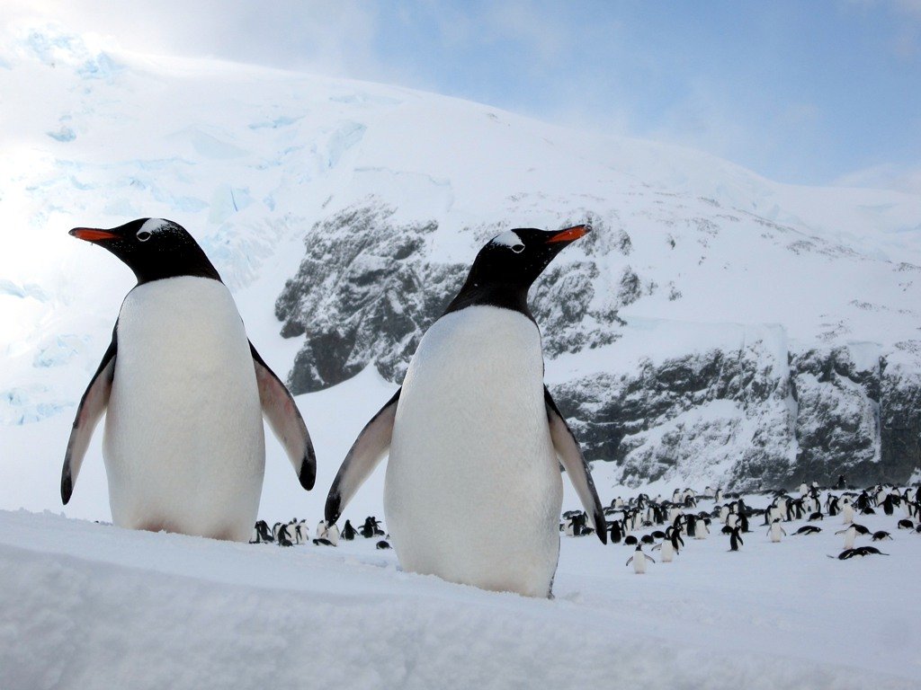
Two gentoo penguins in the foreground, with large group of other penguins on the snowy slopes of Antarctica

Let’s face it: Penguins, like these gentoos, are a big draw of this region.

Sights to See on an Antarctic Peninsula Cruise

Landscapes and Wildlife

Some of the natural wonders to look forward to seeing in Antarctica include:

Unique landscapes: There are many volcanic beaches, frozen tundras and ice caves to explore. Also, melting snow exposes a rugged mountain chain that’s habitat for interesting plant life and invertebrates. 

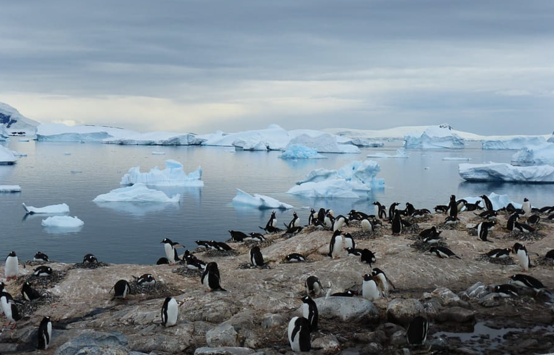
Penguins on the rocks by iceberg-filled water of the Antarctic

In addition to penguins, look out for seals, whales and other seabirds.

Wildlife: The Antarctic Peninsula has numerous wildlife species, including majestic whales and albatrosses and other seabirds. You’re sure to see different types of penguins, including the gentoo, chinstrap and Adélie penguins, as well as crabeater, leopard and Ross seals.

Calving glacier with parts crashing down into Neko Harbor

Neko Harbor is a good spot to try to catch a calving glacier as it sheds massive chunks of ice.

Glaciers: Witness the beauty of massive glaciers, from those towering above Lemaire Channel to the calving ones in Neko Harbor, which shed massive chunks as they go through valleys and deep fjords. Those pieces that have broken off? We call them icebergs. 

Snow-covered rock formation in Lemaire Channel, Antarctica

Lemaire Channel

Giant icebergs: The Antarctic Peninsula is home to some of the world’s largest and most spectacular icebergs. These floating giants are awe-inspiring sights not to be missed.

Red buildings of the Paradise Bay Research Station, with people outside on the snow of the Antarctic Peninsula

Paradise Bay Research Station

Must-Visit Locations on an Antarctic Peninsula Cruise

Deception Island

First discovered by seal hunters in 1820, the island was named for the way it deceived explorers — both by its concealed entry point, called Neptune’s Passage, and by its seemingly safe harbor, Port Foster, which sits within an active volcano. The harbor is actually a caldera, where the top of the volcano collapsed and gives the island its ringlike shape. 
More than 50% of the island is covered by thick glaciers and is home to various wildlife species. The harbor and its black sand beaches are popular destinations for tourists and scientists alike. There are also hot springs, where visitors can take a dip in the 98.6ºF water.

Half Moon Island

Half Moon Island is home to many penguins, seals and seabird species. Part of the South Shetland Islands, Half Moon boasts incredible views made even more spectacular by its crescent shape.

Paradise Bay

Paradise Bay is a popular cruise ship destination and one of the two main Antarctic ports. It’s rich in wildlife, including penguins, seals and whales. It is also home to a research station where visitors can learn more about the Antarctic environment. On a clear day, you can see the snow-covered peaks of Adelaide Island in the distance. 

Historical Sites

Visit abandoned research stations, such as Palmer Station and Port Lockroy, to learn about the history of human exploration and habitation in Antarctica.

These sites offer a fascinating glimpse into the past, with artifacts and photographs from many decades ago providing insight into what it was like to be a scientist in the Antarctic. 

Breathtaking Sunrises and Sunsets

Finally, don’t miss the breathtaking sunrises and sunsets in Antarctica. Get up early to catch the first light of dawn and watch as the sky changes colors from pastel shades to deep orange-red. 

At night, witness the mesmerizing beauty of the stars twinkling above the icy landscape. It’s an experience you’ll never forget! –Kayla Gallocher

Icebergs in the Antarctic, with purplish sky and water

The white of icebergs and glaciers contrast sharply with the beautiful blues and purples of the sky and water.

A Guide to Visiting Hierve el Agua: Oaxaca’s Stunning Petrified Waterfalls

Calling all nature lovers! Tips to experience the magic of these breathtaking mineral springs — a mysterious example of Mexico’s natural beauty.  

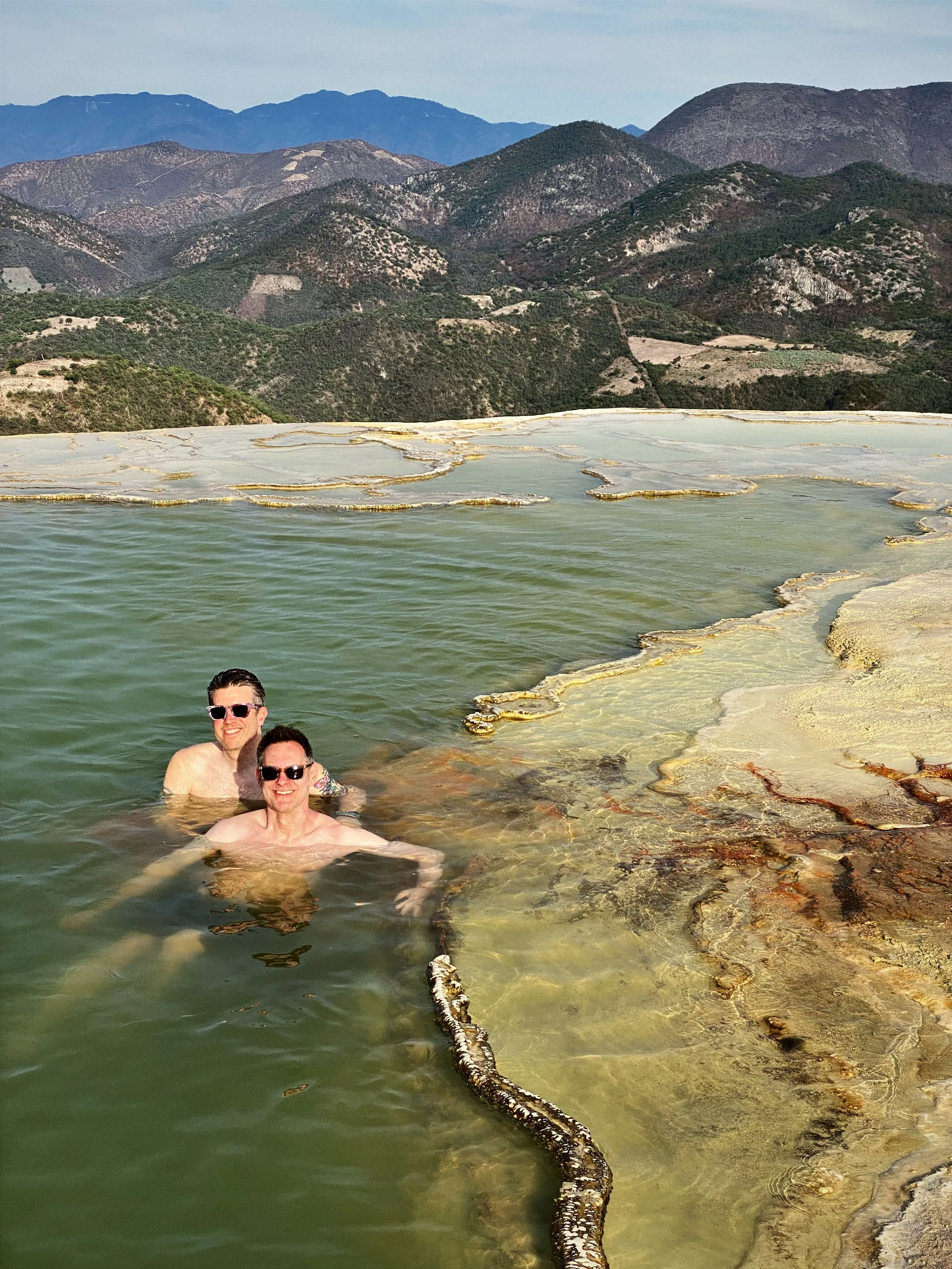
Two men swimming by calcified waterfall at Hierve el Agua in Oaxaca

If you’re in the Oaxaca area, we definitely recommend a day trip to Hierve el Agua.

I’ll admit it. After speaking with a friend who had recently been to Oaxaca, I was initially reluctant about visiting Hierve el Agua, the calcified waterfalls and spring-fed mineral water pools outside of the city of Oaxaca de Juárez. I told Wally, “It’s going to take us a couple hours to get there, and it might be too crowded.” Plus, after scrolling through dozens of images on Instagram, it seemed like the main purpose of the site was to provide opportunities to take aspirational selfies of the infinity pool overlooking the mountains and reflecting a bright blue sky. I was wrong. 

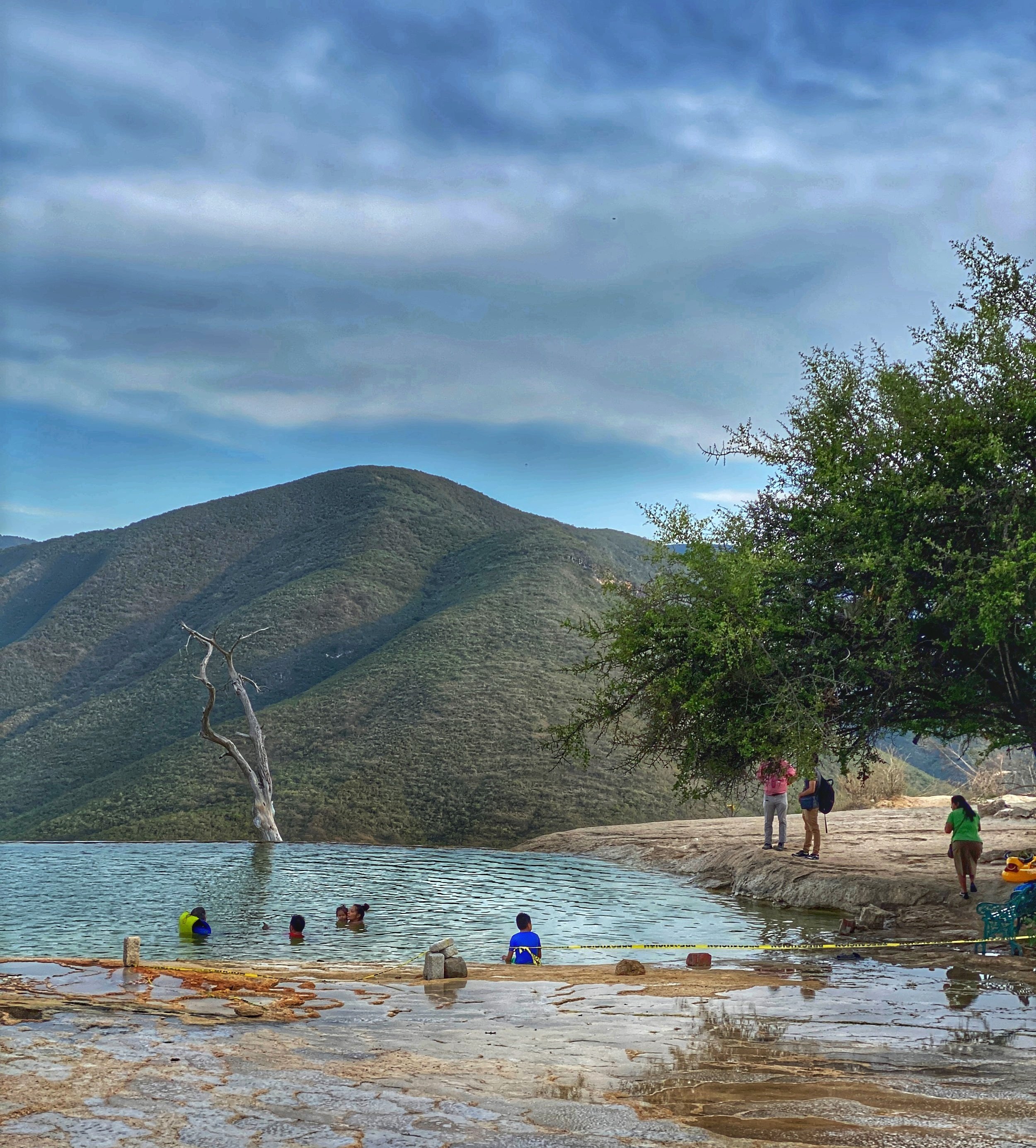
Swimmers in pool at Hierve el Agua with iconic dead tree in the mountains

Natural springs form a sort of infinity pool perched at the edge of a cliff, looking out over the Sierra Madre mountains.

Our friend Kevin, who lives in Oaxaca, said it was one of his favorite places to watch the sun set and insisted we had to see it. Wally pleaded. I was convinced — especially after I insisted we make it a day trip and visit the Iglesia de San Jerónimo Tlacochahuaya and the legendary candlemaker at Casa Viviana en route.

Calcium has left behind a suspended mineral formation that looks like a frozen waterfall.

You’d better hurry up and get to Hierve el Agua while there are still entrance passes left!

Hierve el Agua: Almost Closed for Good

The popular geologic wonder is located in the town of San Isidro Roaguía, in the municipality of San Lorenzo Albarradas, about 42 miles, or a two-hour drive  southwest of Oaxaca de Juárez. In English, Hierve el Agua means  “Boil the Water.” Don’t let the name fool you, though: This refers to the oxygenated spring water that naturally bubbles up out of the ground from an aquifer — not the temperature of the pools, which is around 72°. 

Man in Bimbo t-shirt with arm around another man in front of petrified waterfalls of Hierve el Agua

Wally and Duke hiked down to the lookout, with the calcified waterfall in the background.

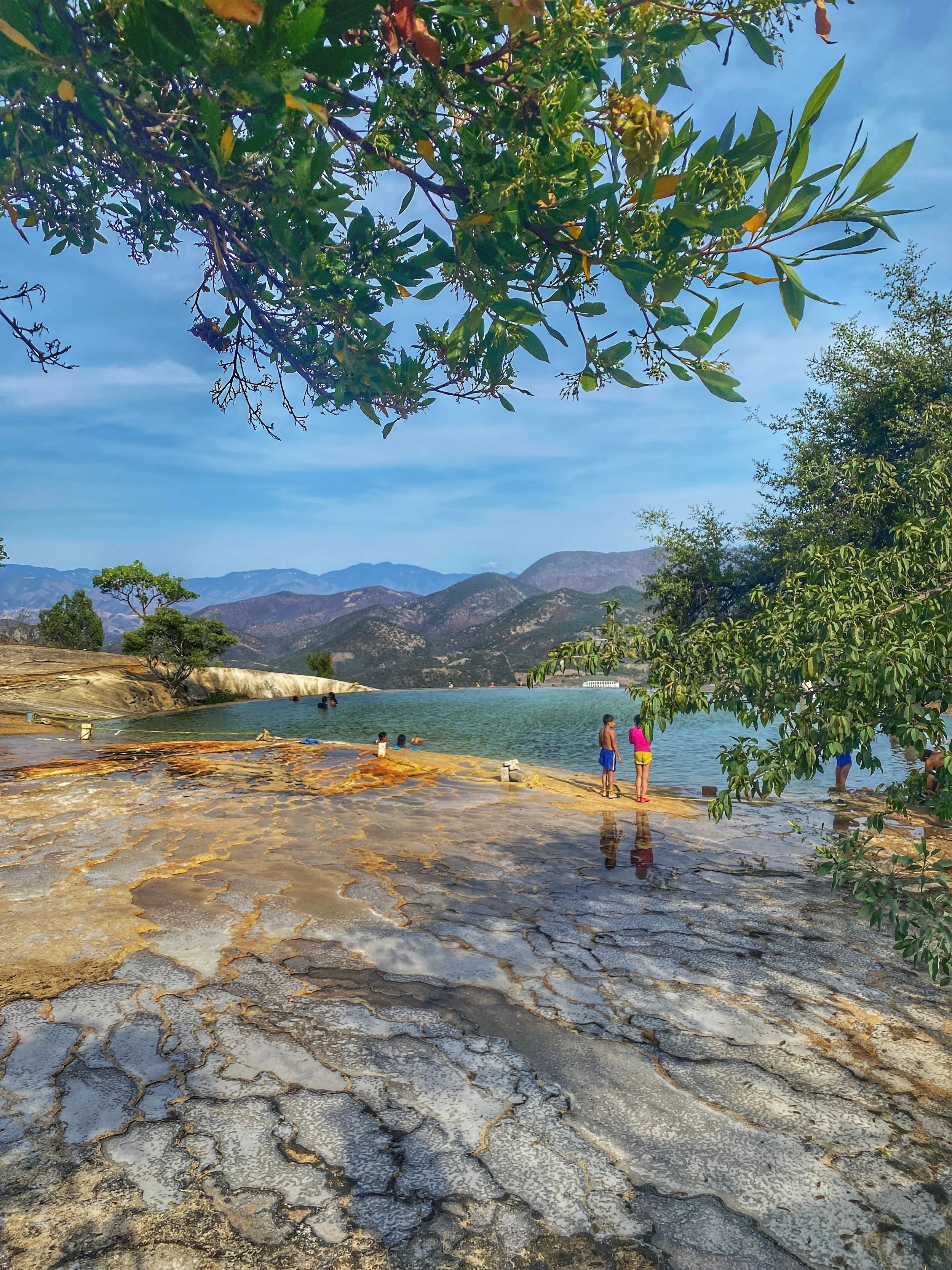
Stoney ground and pools in the mountains at Hierve el Agua in Oaxaca, Mexico

Despite its name, which translates to “Boil the Water,” these aren’t hot springs.

Pro tip for getting there: Check if the roads are open. In April 2020, residents of the municipality of San Lorenzo Albarradas, which encompasses the rugged mountainous region where Hierve el Agua is situated, blocked off one of the roads leading to the popular attraction. The abbreviated version as to why was twofold: to curb the spread of COVID, and to manage the influx of visitors. Pre-pandemic numbers fluctuated between 2,500 to 7,000 visitors per day, which, with high traffic and the ensuing garbage, was having a negative impact on the environment. There was even talk that Hierve el Agua would remain closed.

Thankfully, the natural wonder has reopened, with new rules to prevent overcrowding; the number of visitors per day has been reduced to 200, and entrance fees have been put in place to help maintain the monument and surrounding grounds. 

Our friend Kevin says hello to a dog in the stretch of market stalls leading to the attraction.

The Market and Approach to Hierve el Agua

Our group of four reached our destination in the late afternoon and parked our rental car. We didn’t know about the visitor cap and were fortunate enough to gain admission. What a disappointment it would have been to drive all the way out there, only to be turned away! So, even though Kevin loves to watch the sun set in the mountains, it’s probably best to arrive earlier than later in the day.

We passed stalls selling packaged snacks, water, soft drinks, beer, micheladas and piña loca, a mezcal-based cocktail served in a hollowed-out pineapple, with additional chunks of the fruit drizzled with bright red chamoy sauce and sprinkled with a healthy dose of chile con limón seasoning. 

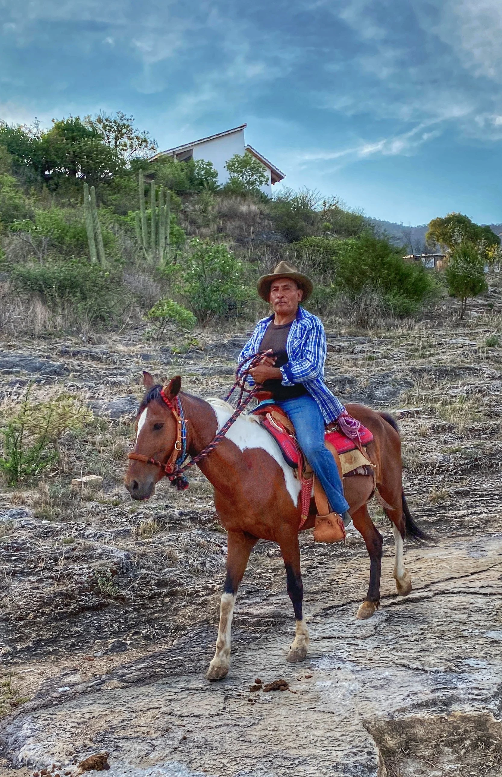
Older cowboy on brown horse with white patches on trail at Hierve el Agua

Giddy up! A vaquero, or cowboy, rides down the trail to the springs.

The walking trail that leads to the main area where the pools are was a bit steep but offered sweeping panoramic views of the Sierra Madre del Sur mountain range and the outlying valley, which was occasionally interrupted by monstrously tall flowering agave stalks. I was grateful that I brought my Teva sandals, which have great support and traction — I couldn’t imagine attempting to traverse the path in flip-flops.  

Looking down at the pools in the mountains at Hierve el Agua

There are a few different pools to explore at Hierve el Agua.

Elevated Expectations: Petrified Waterfalls and Mineral Springs

Locals revere the waters for their sacred healing properties. And while the basins are man-made, the underground spring that feeds them is natural. Because the pools are full of mineral-rich deposits of calcium carbonate, magnesium and sulfur, they had a yellowish hue. 

Women in the mineral spring at Hierve el Agua, one floating on her back, with green mountains all around

The pools are refreshing — with the water temp being about 70º.

Although it was spring, it was still quite hot. Be advised that you’ll be exposed to direct sunlight since there really isn’t any shade on the plateau. Also, be sure to stay hydrated; at 5,000 feet above sea level, it’s one of the highest elevation points in Oaxaca state, and your body loses water through respiration at high altitude twice as fast as it does at sea level. 

Rock formations that look like a lunar landscape  at Hierve el Agua

The rock formations by the mineral springs resembled a lunar landscape.

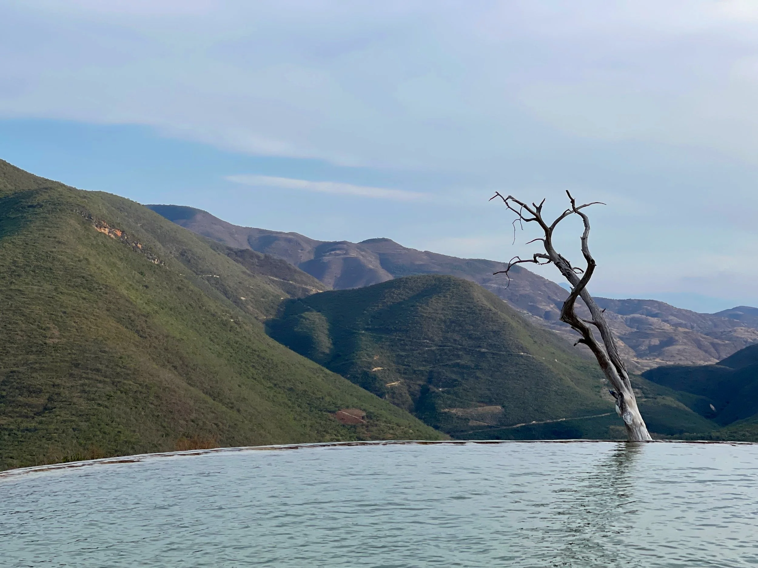
The leafless gnarled tree at the edge of the main pool surrendered long ago. But it has become iconic of Hierve el Agua, so it pissed us off to see a visitor had hung their bag from one of its twisted branches. 

Dead tree reaching up to sky by pool in the mountains at Hierve el Agua

The famous dead tree at the edge of one of the pools

Kevin and his amigo David decided to hang back and relax, but Wally and I wanted to check out the trail that leads to the larger of the two petrified “waterfalls” to get a closer look. The hike itself is 1.6 miles long, with an elevation change of 623 feet. You’ll find a couple of benches and a covered pavilion at the top of the trail to relax and hydrate after you’ve completed the trek. 

Cool rock formation on cliff face at Hierve el Agua

Take a break from mezcal and folk art and admire the natural wonder of Hierve el Agua.

Cacti and other vegetation in the Sierra Madre mountains

The surrounding landscape and foliage is also impressive.

Trees growing by rock around the mineral springs at Hierve el Agua

Hierve el Agua is a picture-perfect way to spend an afternoon.

There are two petrified waterfalls at Hierve el Agua. Rising up from near-vertical cliffs, there’s the 98-foot, nine-story-high Cascada Grande and the smaller 39-foot, four-story-high Cascada Chica. These formations are the result of mineral-rich spring water that has trickled over the cliff face for thousands of years. It’s similar to the way that a candle drips wax down the side of a bottle while melting. As a result, the calcium has left behind a suspended mineral formation that looks like a frozen waterfall. 

Two petrified waterfalls in the Sierra Madre mountains in Mexico

La Cascada Grande is nine stories tall!

After our hike, Wally and I took a plunge to cool off, which felt great after being exposed to the sweltering Oaxacan sun. 

Two men in sunglasses cooling off in a pool in the mountains at Hierve el Agua

Wally and Duke cool off after their hike.

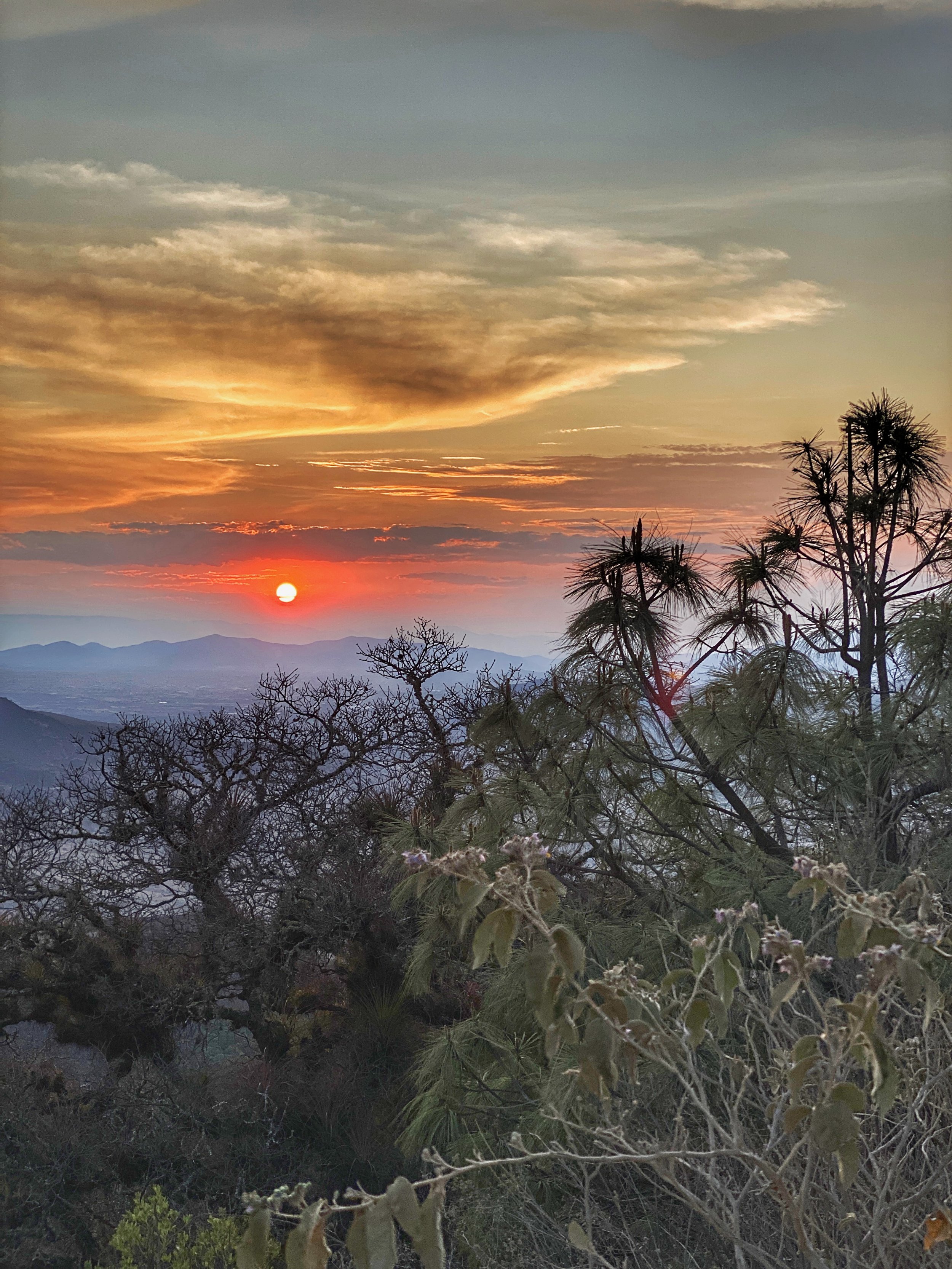
We packed up and headed back to the car. As the sun began to set, Kevin stopped the car so we could get out and take one last look at this stunning landscape. We gazed out over the mountains, and I reflected on the pleasant day, grateful for having experienced the geological marvel in person, and for having spent it among friends. –Duke

A red and orange sunset over the foliage of the Sierra Madre mountains in Oaxaca state, Mexico

If you can, time your trip to catch a gorgeous sunset in the mountains on your way home.

The Lowdown 

Hours: 7 a.m. to 5 p.m.

Parking: 100 pesos ($5)

Admission: 50 pesos ($2.50) per person

Bring: Sunscreen, footwear that can get wet and has good traction, and bottled water (though you can buy drinks and snacks at the market)


Preserving the Magic of the Amazon

The largest rainforest on Earth cleans our air and water. But it’s rapidly being destroyed. Here are 3 ways you can help save the Amazon Rainforest — including an ethical visit. 

The largest rainforest on the planet helps keep our air and water clean.

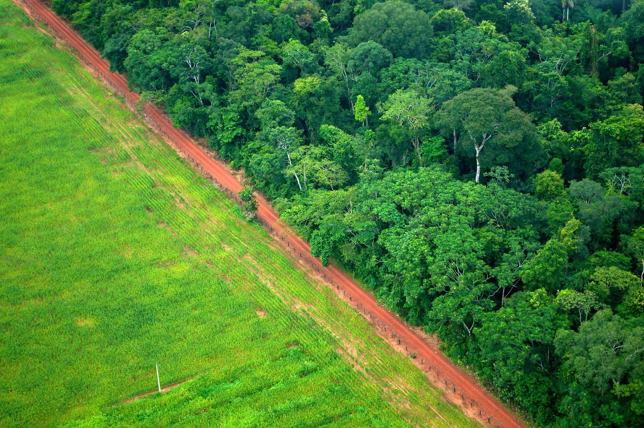
As the world’s biggest rainforest, the Amazon has several functions crucial to our planet’s environmental health. Alarmingly, it’s also one of the foremost victims of the climate crisis. In 2022 alone, 430 square kilometers of the Amazon was destroyed. That’s over 126 times the size of Central Park in New York City.

The Amazon, which produces one-fifth of the Earth’s oxygen, is being cut down at an alarming rate.

Why We Need the Amazon Rainforest

While it comprises only 2% of the world’s landmass, the Amazon is responsible for producing 20% of the oxygen on the planet. One of its primary functions is to sequester carbon — or, in other words, gather large amounts of carbon dioxide and convert them to oxygen. Carbon sequestration benefits us by cleaning air and water sources. The process can even control flooding. This is why the Amazon is rightfully known by the moniker “the Lungs of the Earth.”

Unfortunately, the forest and its inhabitants continue to struggle against several issues. The foremost challenge it faces today is rapid deforestation due to agriculture, mining, logging and construction. 

Ultimately, assertive legislation is key to reversing the damage done to the Amazon. This was made clear when Brazil’s deforestation policies in the mid-2000s eased the rate of destruction in the rainforest, according to a study by the University of Arizona

Yet, while policies play a crucial role in saving the Amazon, there are many ways for you as an individual to contribute to its preservation.

A satellite image that shows the deforestation of the Amazon — the same image from less than a decade ago would have been all dark green.

3 Ways to Help Save the Amazon

In Brazil, beef is raised for consumption on land that was once part of the Amazon.

1. Practice mindful consumption. 

The majority of deforestation efforts come about due to the production of items like paper, wood and beef. 

Minimize your use of paper to help reduce the demand for its production. You can also check for an FSC label to find out if your paper was sourced ethically and doesn’t threaten endangered animals that rely on trees for survival.

Brazil, where 60% of the Amazon is located, is also a major producer of beef. The biggest beef producer in the region, JBS S.A., raises cattle from deforested Amazon land. On the whole, around 70% of the Amazon is deforested to raise cattle for beef. While not everyone wants to be a vegetarian, you can reduce consumption to help decrease the demand for beef production.

Consider volunteering for groups like the Rainforest Action Network that protest against the stealing of indigenous lands and the deforestation of the Amazon.

2. Connect with advocates and organizations. 

There are countless grassroots organizations and initiatives dedicated to preserving the Amazon. For instance, the Rainforest Action Network (RAN) successfully pushed Burger King to stop using rainforest beef. 

You can join local groups in your area or support larger ones like the RAN or Amazon Watch. They can use your help in their efforts to call out and boycott businesses that support deforestation in the region.

If you want to visit the Amazon, make sure you go through a group that focuses on preservation of this valuable natural resource.

3. Make an ethical trip to the Amazon. 

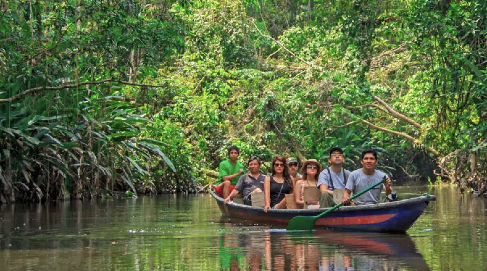
If you want to see Amazon for yourself, be sure to do so in an ethical and respectful manner. After all, just like the Daintree Forest in Australia, the Amazon is also a UNESCO World Heritage Site. To visit the Amazon ethically, look for accommodations that work with environmental preservation initiatives. These providers offer guides and activities that immerse you in the Amazon’s biodiversity. And you might even end up lending a hand to their preservation efforts!

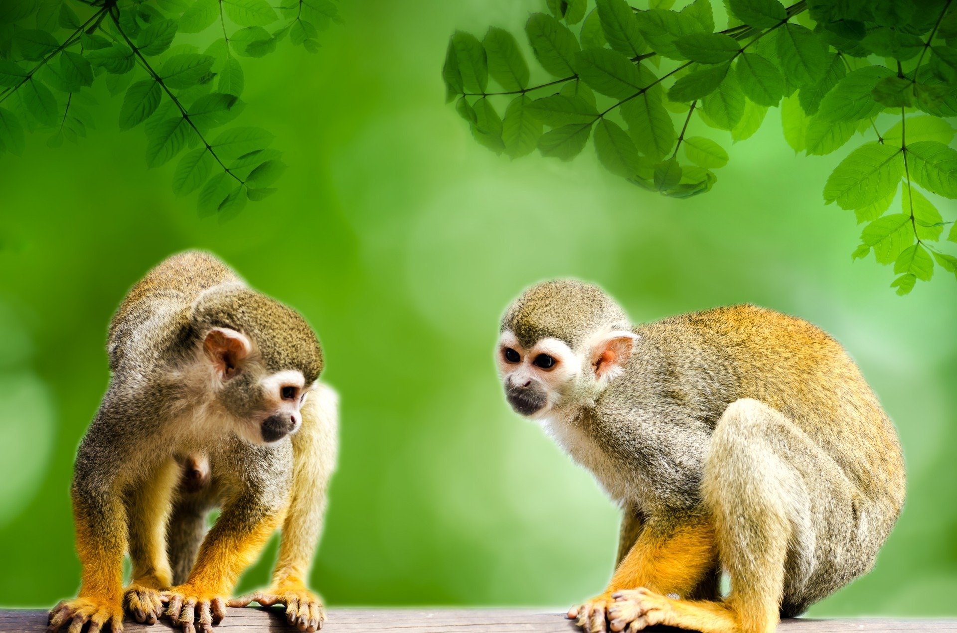
Two adorable squirrel monkeys in the Amazon

These adorable critters, known as squirrel monkeys, are just some of the wildlife you could see in the Amazon.

The paper and beef industries are destroying the largest rainforest on Earth. Do your part to help stop these atrocities.

The Amazon and its rapid degradation is of urgent concern. As it is responsible for several processes that keep the environment in good health, everyone should be involved in helping preserve it. –Alyson Yesha Corbett

5 of the World’s Most Underrated Adventure Travel Destinations

The lemurs of Madagascar, the prayer flags of Nepal, the rock faces of South Korea, the azure waters of Slovenia and the mountainside fortresses of Bhutan: These are the best-kept secret destinations for trekking and other outdoor activities.

templeofgurupadmasambhava.jpg

The Temple of Guru Padmasambhava is just one of the many delights found in Bhutan, one of the lesser known (albeit a bit tricky to visit) adventure travel destinations.

Choosing a destination for your next adventure can feel downright overwhelming. Trekking in Greenland? Bouldering in Utah? Paddling the Caribbean? Throwing a dart at a map and hoping it lands somewhere cool?

When the entire globe is your playground, it can be tough to choose. Hey, nothing like a list of suggestions to get the wheels turning, right? 

Madagascar is an adventure travel destination that rivals the Galapagos in the “did I just step into a Dr. Seuss book?” factor.

Here are five of the world’s most underrated adventure travel destinations, all with their own unique appeal. Maybe that means the bucket list just got five lines longer. Better get planning!   

Baobad trees in Madagascar definitely up the Dr. Seuss factor.

Baobab trees in Madagascar definitely up the Dr. Seuss factor.

1. Madagascar 

This far-flung island off the eastern coast of Africa isn’t just dancing lemurs — it’s an adventure travel destination that rivals the Galapagos in the “did I just step into a Dr. Seuss book?” factor. For lovers of nature, this island boasts biodiversity in spades, with chameleons, primates, frogs and sealife calling it home. For adventurers, its lack of cars means every step becomes part of an exploratory trek. 

Many spots on Madagascar are home to lemurs.

Many spots on Madagascar are home to lemurs.

Between Madagascar’s Mantadia and Ranomafana National Parks, visitors will find miles and miles of hiking trails seemingly from another planet. After exploring inland, adventurers can migrate to the coast to unwind at pristine stretches of beach, like the impossibly turquoise Nosy Be island, which doubles as a lemur habitat. 

Prayer flags are found throughout Nepal. They’re said to carry prayers and mantras on the wind.

Prayer flags are found throughout Nepal. They’re said to carry prayers and mantras on the wind.

2. Nepal 

Perched atop the spine of the planet, Nepal might not seem “underrated” at all. Here’s the thing: With big names like Everest within its borders, it’s certainly one of the ultimate adventure destinations of the world. 

The base camp at Everest, the highest mountain on the planet, is a colorful spot to kick off a trek.

The base camp at Everest, the highest mountain on the planet, is a colorful spot to kick off a trek.

However, it’s a country that can feel entirely too challenging or out of reach for many travellers. When its main attraction is the tallest mountain on Earth, Nepal can be a bit intimidating to the masses. But you can, and should, visit even if you’re not planning on setting foot in a base camp. There’s something about trekking in Nepal, prayers flag fluttering overhead, rhododendrons blooming, towering peaks in the foreground… It’s magical. Don’t keep putting it off until you’re better, older, wiser, whatever. 

Paro Taktsang, a Buddhist monastery in Bhutan, clings to the cliffside.

Paro Taktsang, a Buddhist monastery in Bhutan, clings to the cliffside.

3. Bhutan 

As much as the idea of isolation has taken on an entirely new meaning in the recent past (curse you, COVID!), Bhutan exemplifies one of the most fascinating applications of isolation in the tourism world. Having only just allowed television into the country in 1999 and still prohibiting the sale of goods like tobacco, Bhutan has opened to the ideas of the rest of the world on its own schedule. This includes tourism.

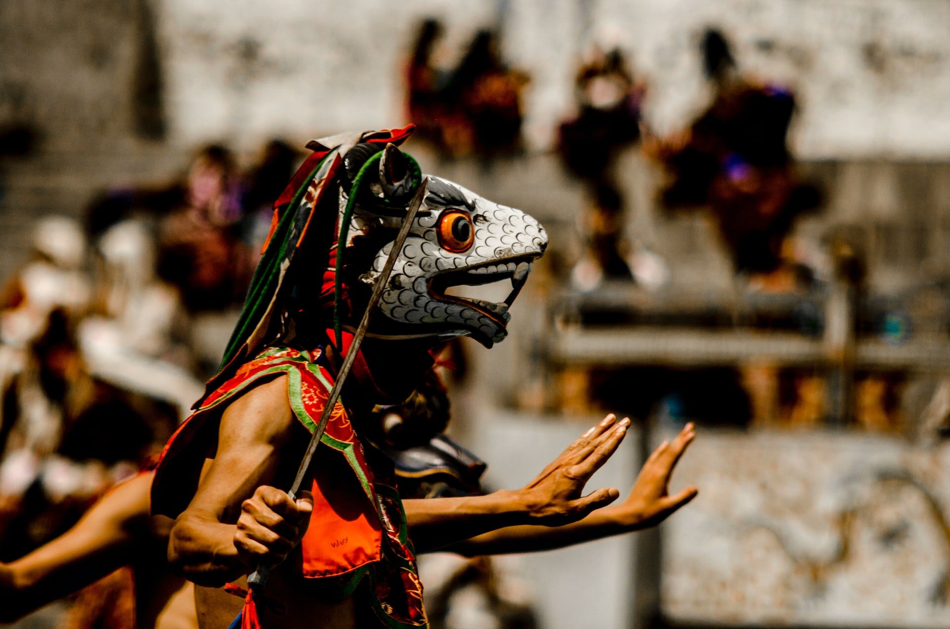
The masked dances of Bhutan take place annually. Try to catch one — it’s said to purify the soul and bring good luck.

The masked dances of Bhutan take place annually. Try to catch one — it’s said to purify the soul and bring good luck.

Even getting into Bhutan feels a bit like jumping through hoops. You’ll need to be invited by a citizen of the country (unless you hold a passport from India, Bangladesh or the Maldives), or be a guest of the government. You’ll be required to pay a set daily fee to see the country, and the geographical isolation of the nation makes flights costly and complicated. 

However, if you manage to wrangle a visit, you’ll be rewarded with some of the most exceptional, unspoiled scenery the world has to offer, as well as a rich culture developed without interruption from the outside world. From 7,000-meter summits to lush green valleys, the natural landscape is simply unreal. Of course, the dzongs (fortresses) perched atop impossibly steep cliffs are one of the gems of Bhutan. The chance to explore this unknown destination is a rare treat and undoubtedly worth the effort. 

Cycling and great food come together for wellness travels in South Korea.

Cycling and great food come together for wellness travels in South Korea.

4. South Korea 

This small country (slightly larger than the U.S. state of Indiana) is an absolute goldmine when it comes to outdoor adventure. And South Korea’s relative lack of “hype” in the adventure travel world is a blessing in disguise. 

Rock climbers will find numerous sites for adventure in South Korea.

Rock climbers will find numerous sites for adventure in South Korea.

While others flock to Iceland and the Rockies, you can discover South Korea’s expansive hiking trails and climbing-ready rocky cliffs in peace. There are 20 mountains a stone’s throw from Seoul, making outdoor adventure an easy outing once you’re done eating your way through the capital (which you definitely should). Rock climbers will find more places than they could hope to cover in one trip, and many of these locations are so beautiful that the locals believe spirits call them home.

Because of a robust road system, South Korea is a must for cyclists looking to put in miles somewhere new, and the snowy slopes near Pyeongchang are perfect off-the-beaten-path destinations for snow sports enthusiasts. No shortage of adventure to be had here!

A small isle in Lake Bled in Slovenia is home to the Pilgrimage Church of the Assumption of Mary.

A small isle in Lake Bled in Slovenia is home to the Pilgrimage Church of the Assumption of Mary.

5. Slovenia

Slovenia typically isn’t considered one of Europe’s many top-notch travel destinations. But as incredible as Italy and Spain will always be, Slovenia is truly one of the most underrated adventure travel destinations in the world. 

The gorgeous Soca River in Slovenia is a great spot for kayaking, rafting and other water sports.

The gorgeous Soca River in Slovenia is a great spot for kayaking, rafting and other water sports.

It’s a teeny country, but it offers the Slovenian Alps, the bright blue Soca River, hidden beaches on seaside stretches and beautiful Lake Bled. Whether you’re looking to kayak, swim, hike, go canyoneering or just savor a fantastic view, Slovenia delivers. Plus, you’re not going to be battling crowds or dodging selfie sticks while you explore. 


Apologies in advance for the wanderlust. Which of these underrated adventure travel destinations will you be visiting first? –Lukas Saville

The Gorgeous Calanques of Cassis

Calanque Port-Miou, Calanque Port-Pin and Calanque d’En-Vau: The French Riviera limestone cliffs provide a picturesque day trip if you’re in Provence.

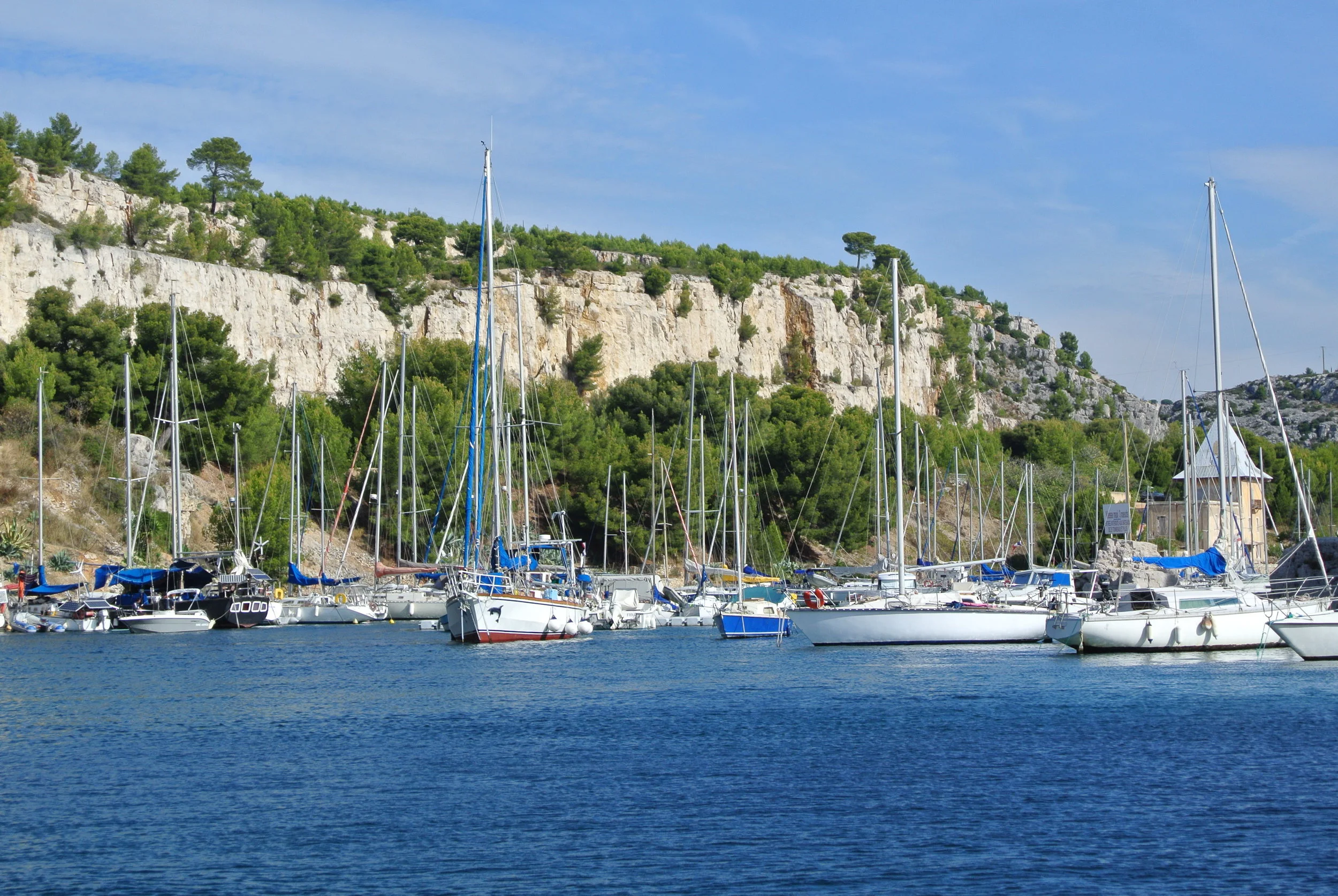
The Port of Cassis on the French Riviera, with its pretty backdrop of the limestone cliffs called calanques

The Port of Cassis on the French Riviera, with its pretty backdrop of the limestone cliffs called calanques

It may be difficult to imagine taking time away from the idyllic town of Aix-en-Provence, France. However, not far from its leafy boulevards and gurgling fountains, the laidback coastal fishing village of Cassis, located between Marseilles and Bandol, makes for an ideal day trip.

Wally’s mom, affectionately referred to as “The Shirl” had brought and read about the Calanques of Cassis, white limestone cliffs at the water’s edge, in Rick Steves’ Provence & The French Riviera travel guide. So I suppose, in a way, we have Mr. Steves to thank for our excursion.

Limestone from the calanques of Cassis was used to build the Suez Canal as well as the base of the Statue of Liberty.
calanques1

How to Get There

The four of us set off for Cassis and took the train from the Aix-en-Provence TGV railway station to Marseille. At the Gare de Marseille Saint-Charles, we purchased tickets to the Gare de Toulon train station, about 15.5 miles southeast of Marseille.

Once in Toulon, we boarded a bus that twisted and wound its way down a steep hillside until we arrived at the Port of Cassis.

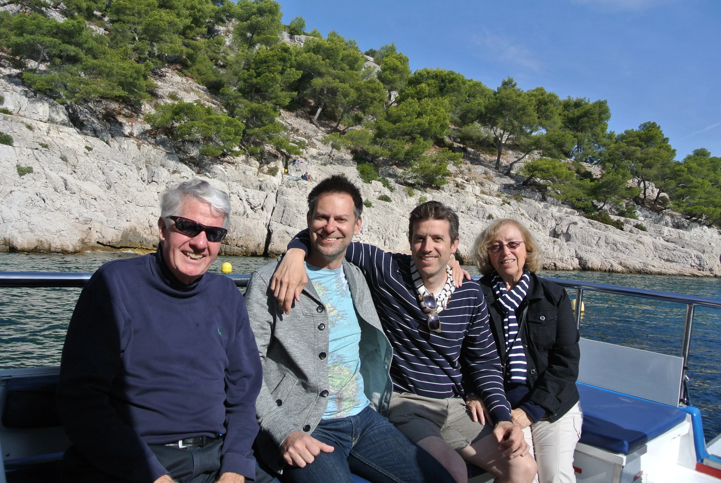
Wally’s dad, Duke, Wally and the infamous Shirl on their boat excursion to see the calanques

Wally’s dad, Duke, Wally and the infamous Shirl on their boat excursion to see the calanques

The Calanques

Chartered boat tours are available for different durations. You can visit the first three in a 45-minute trip, or go as far as all nine in one and a half hours.

We opted for the 45 minute excursion, which included Port-Miou, Port-Pin and d’En-Vau.

The name of our boat was Le Calendal, a small vessel that holds a maximum of 12 people.

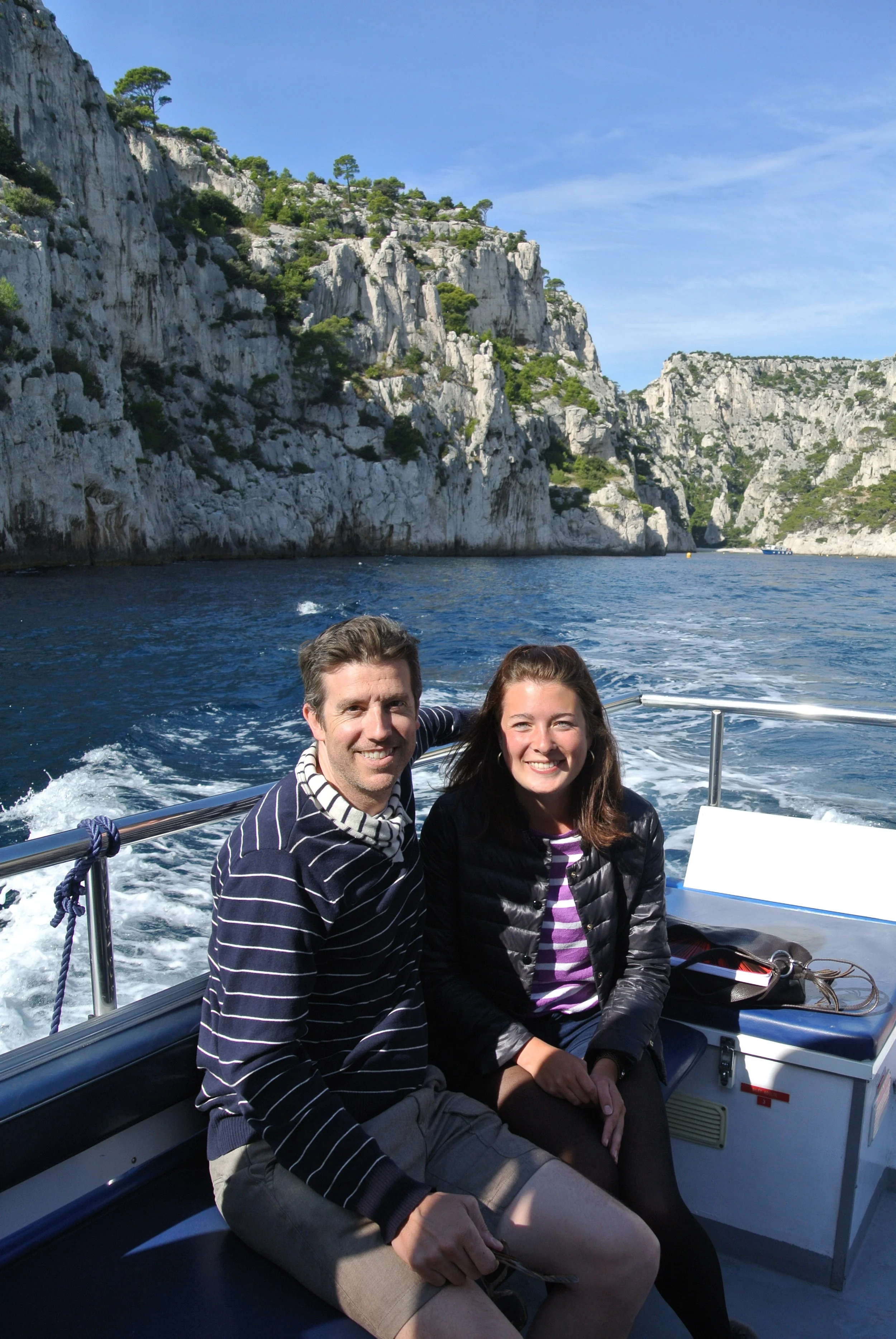
On our voyage, we met and struck up a conversation with a charming au pair from Düsseldorf, Germany named Alexandra.

Wally with his new acquaintance, a German au pair

Wally with his new acquaintance, a German au pair

As our boat departed the harbor, our captain, Didier Crespi, pointed out the 14th-century fortress, Château de Cassis, built atop a cliff that juts out into the Mediterranean. Converted into a luxury hotel, the grounds are not open to the public, but should you wish to see them, you can book a junior suite for $350, or opt for the Chloe Suite, with a private terrace overlooking the azure waters of the Cote D'Azur for $690.

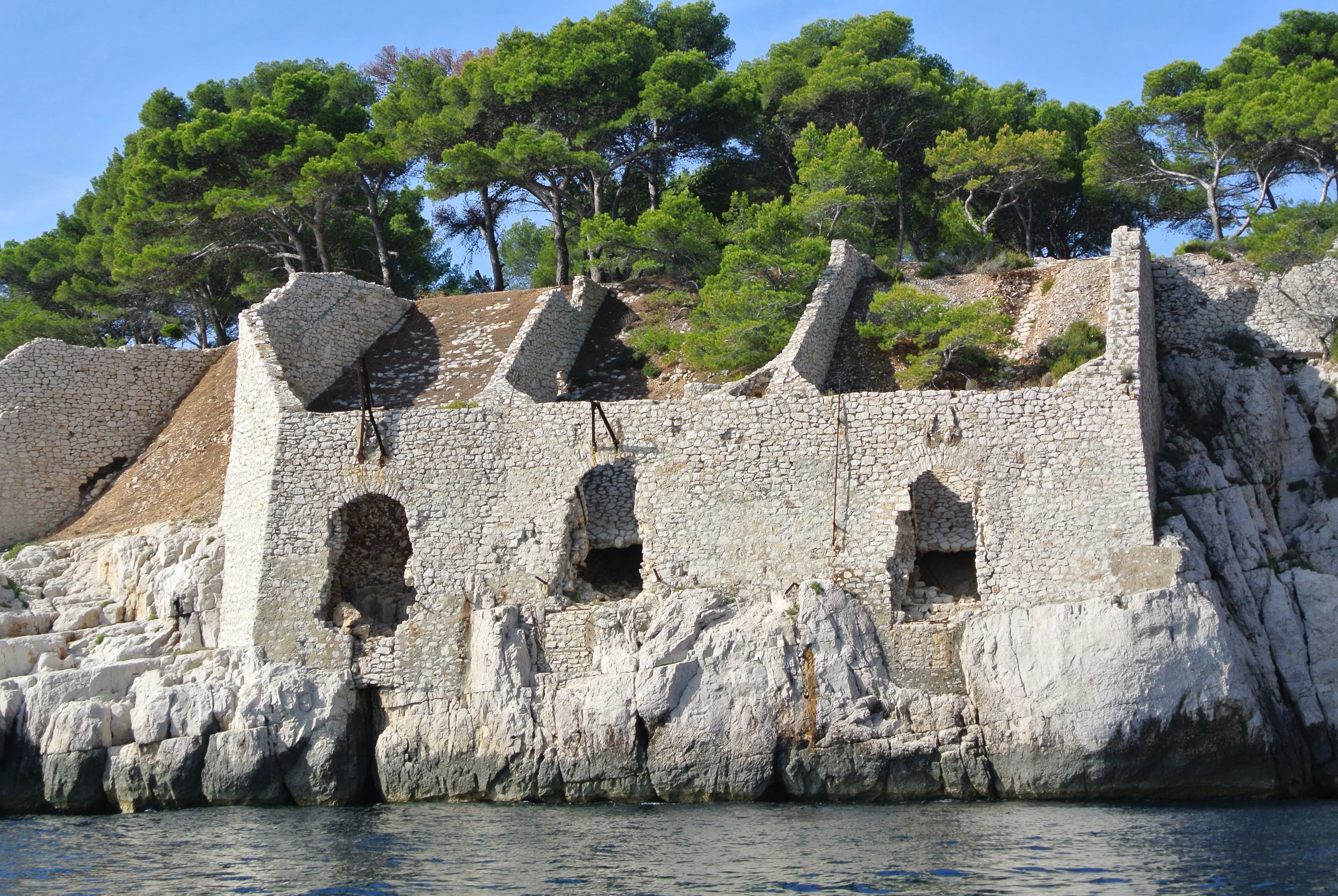
We passed the remains of a ruined quarry building on Pointe Cacau near the Calanque of Port-Miou.

The struggle of nature: Water wears away at the cliffs while plant life somehow finds a way to take hold

The struggle of nature: Water wears away at the cliffs while plant life somehow finds a way to take hold

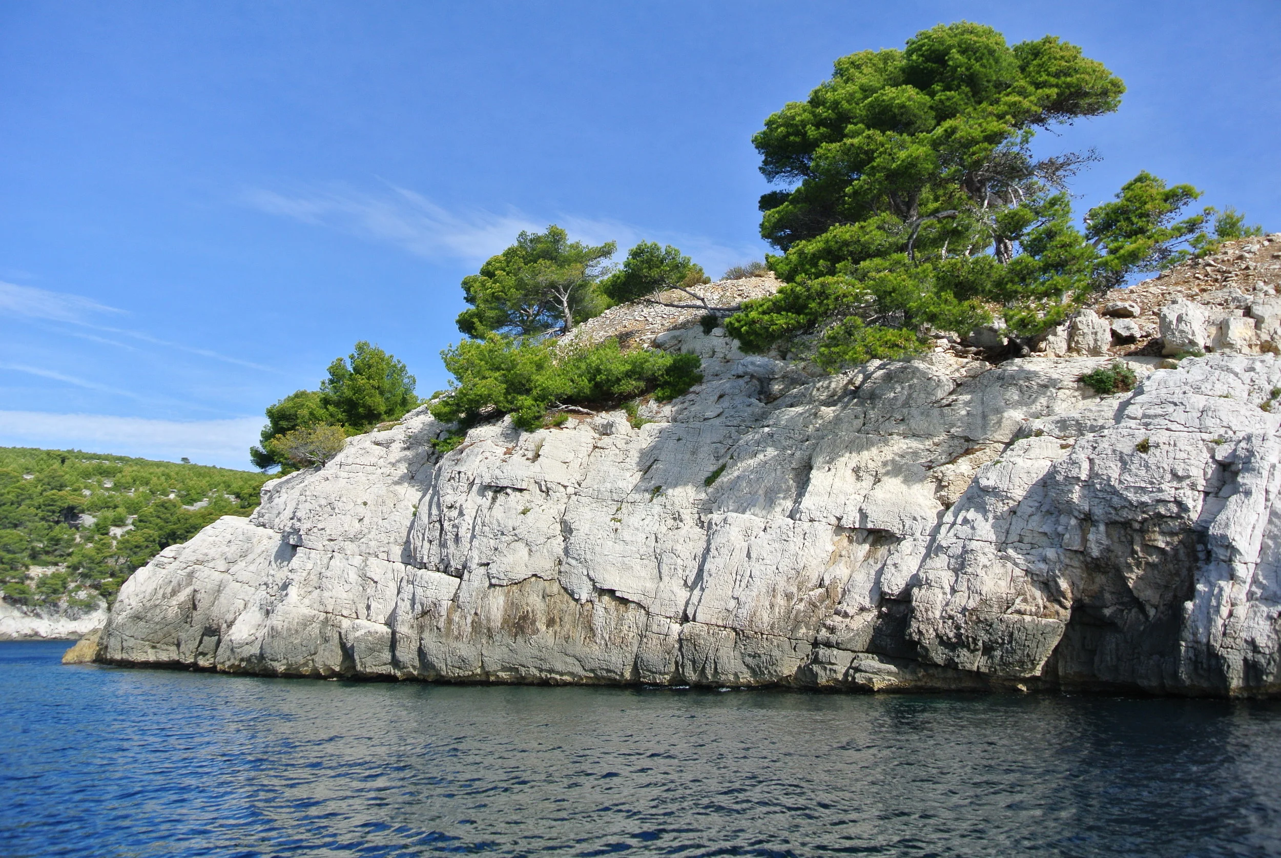
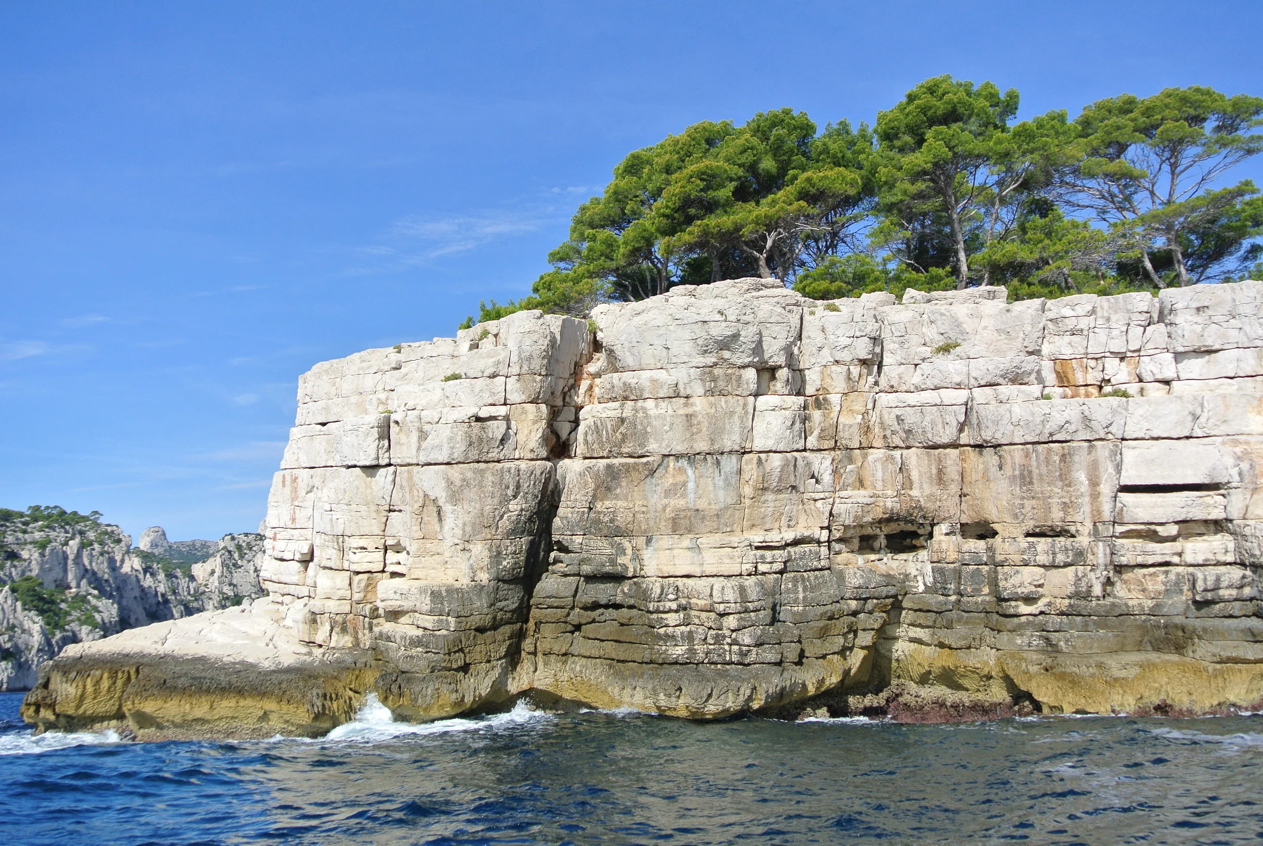
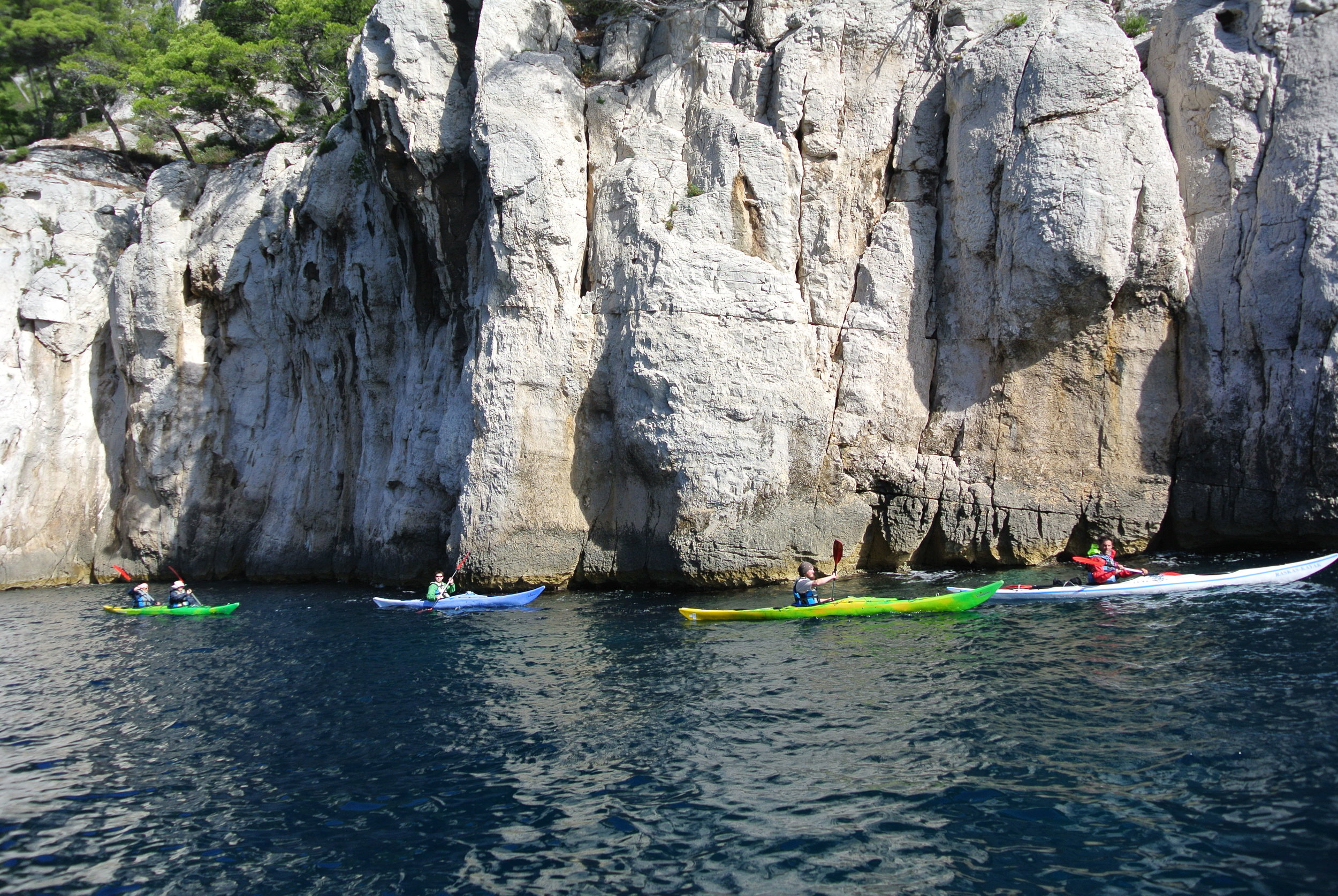
The craggy limestone formations are dotted with pine and juniper trees that have taken root and grow in minimal soil amongst the cracks and crevices.

The remains of a limestone quarry, a popular building material and primary export for the town

The remains of a limestone quarry, a popular building material and primary export for the town

Captain Crespi told us that white limestone was the primary export of Cassis and provided the natural building material used to construct quays in major port cities from Alexandria to Algiers, as well as the channel walls of the Suez Canal, connecting the Mediterranean with the Red Sea. This same stone was even used to create the base for the Statue of Liberty.

You can kayak, hike to a hidden beach, risk your life rock-climbing — or you can just take it all in on a boat excursion

You can kayak, hike to a hidden beach, risk your life rock-climbing — or you can just take it all in on a boat excursion

Le Capitaine dropped anchor in the sheltered crystalline inlet of the Calanque d’En Vau. The sea was a brilliant blue and shimmered like liquid glass. A school of silver-skinned fish paused at the side of our boat as if they were accustomed to our captain’s comings and goings. He threw them some pieces of bread, which they excitedly nibbled at.

On our return to the harbor, we passed a restaurant perched atop the calanques that makes pastis, an anise-flavored spirit and aperitif.

From the water, we could see people relaxing on small private beaches (some of them nude), fishing and hiking. We even saw a rock climber scaling the face of a cliff while we moored.

The landscape was stunning and we all enjoyed our sunny afternoon on the water. –Duke